
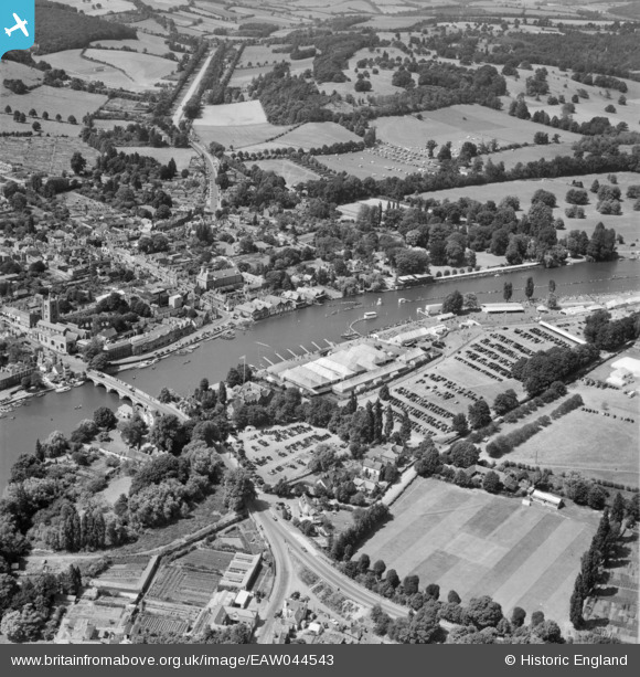
EAW044543 ENGLAND (1952). Henley-on-Thames, the Henley Royal Regatta in progress and the town, 1952
© Copyright OpenStreetMap contributors and licensed by the OpenStreetMap Foundation. 2026. Cartography is licensed as CC BY-SA.
Nearby Images (39)
EAW044543

EAW044545

EAW044544

EAW024273

EPW008861

EAW024274

EAW024272

EAW045423

EPW008856

EAW044517

EPW008860

EPW008853

EAW044537

EPW008865

EAW045426

EAW044541

EAW024271

EPW008858

EAW044540

EAW044549

EAW045424

EPW035809

EAW044516

EPW008857

EAW044538

EAW044547

EAW045422

EAW044551

EAW044536

EAW044552

EAW044553

EPW000855

EPW022749

EAW044546

EPW008863

EAW024270

EAW045425

EAW044542

EPW000853

Details
| Title | [EAW044543] Henley-on-Thames, the Henley Royal Regatta in progress and the town, 1952 |
| Reference | EAW044543 |
| Date | 4-July-1952 |
| Link | |
| Place name | HENLEY-ON-THAMES |
| Parish | HENLEY-ON-THAMES |
| District | |
| Country | ENGLAND |
| Easting / Northing | 476359, 182859 |
| Longitude / Latitude | -0.89886766914107, 51.538981558864 |
| National Grid Reference | SU764829 |
Pins
Be the first to add a comment to this image!