
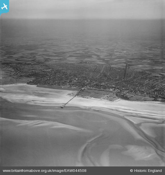
EAW044508 ENGLAND (1952). The pier and town, Southport, from the north-west, 1952
© Copyright OpenStreetMap contributors and licensed by the OpenStreetMap Foundation. 2025. Cartography is licensed as CC BY-SA.
Details
| Title | [EAW044508] The pier and town, Southport, from the north-west, 1952 |
| Reference | EAW044508 |
| Date | 4-July-1952 |
| Link | |
| Place name | SOUTHPORT |
| Parish | |
| District | |
| Country | ENGLAND |
| Easting / Northing | 331697, 418149 |
| Longitude / Latitude | -3.0335991167491, 53.655138621819 |
| National Grid Reference | SD317181 |
Pins

redmist |
Thursday 7th of April 2022 11:26:18 PM | |
|
redmist |
Thursday 7th of April 2022 11:25:56 PM | |
|
Bryan |
Sunday 18th of December 2016 04:48:12 PM | |
|
Bryan |
Sunday 18th of December 2016 04:46:39 PM | |
|
Bryan |
Sunday 18th of December 2016 04:45:33 PM | |
|
Bryan |
Sunday 18th of December 2016 04:44:37 PM | |
|
Bryan |
Sunday 18th of December 2016 04:43:31 PM | |
|
Bryan |
Sunday 18th of December 2016 04:39:31 PM | |
|
Bryan |
Sunday 18th of December 2016 04:38:57 PM | |
|
Bryan |
Sunday 18th of December 2016 04:37:32 PM | |
|
Bryan |
Sunday 18th of December 2016 04:36:13 PM |