
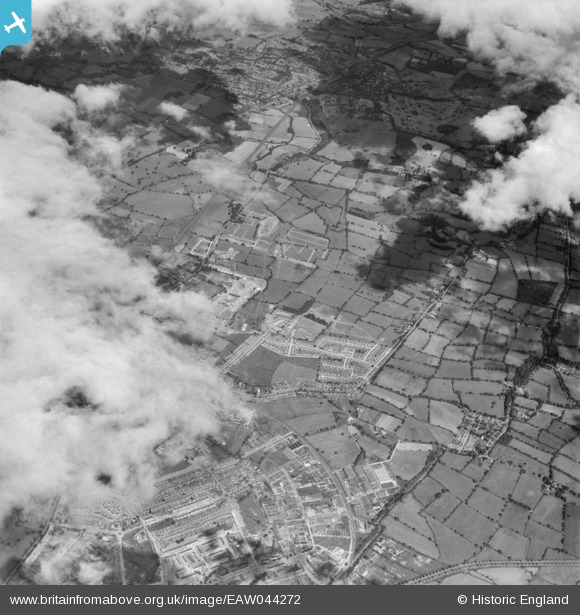
EAW044272 ENGLAND (1952). The town and development to the west of Cowley Hill, Borehamwood, from the south-east, 1952
© Copyright OpenStreetMap contributors and licensed by the OpenStreetMap Foundation. 2026. Cartography is licensed as CC BY-SA.
Nearby Images (16)
EAW044272

EAW027913

EAW027914

EAW027905

EAW027911

EAW027908

EAW027903

EAW027909

EPW041246

EAW027907

EPW041242

EPW041248

EPW041243

EPW041244

EPW041245

EAW027912

Details
| Title | [EAW044272] The town and development to the west of Cowley Hill, Borehamwood, from the south-east, 1952 |
| Reference | EAW044272 |
| Date | 19-June-1952 |
| Link | |
| Place name | BOREHAMWOOD |
| Parish | ELSTREE AND BOREHAMWOOD |
| District | |
| Country | ENGLAND |
| Easting / Northing | 520091, 197165 |
| Longitude / Latitude | -0.26358750855894, 51.659956425174 |
| National Grid Reference | TQ201972 |
Pins
Be the first to add a comment to this image!