
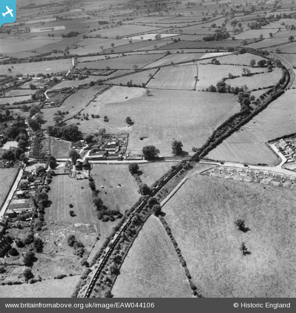
EAW044106 ENGLAND (1952). Grange Farm, the Netherseal Colliery Branch Railway and environs, Linton, from the north-east, 1952
© Copyright OpenStreetMap contributors and licensed by the OpenStreetMap Foundation. 2026. Cartography is licensed as CC BY-SA.
Nearby Images (2)
EAW044106

EAW044107

Details
| Title | [EAW044106] Grange Farm, the Netherseal Colliery Branch Railway and environs, Linton, from the north-east, 1952 |
| Reference | EAW044106 |
| Date | 10-June-1952 |
| Link | |
| Place name | LINTON |
| Parish | LINTON |
| District | |
| Country | ENGLAND |
| Easting / Northing | 427391, 317274 |
| Longitude / Latitude | -1.5941325921962, 52.752048509235 |
| National Grid Reference | SK274173 |
Pins
Be the first to add a comment to this image!