
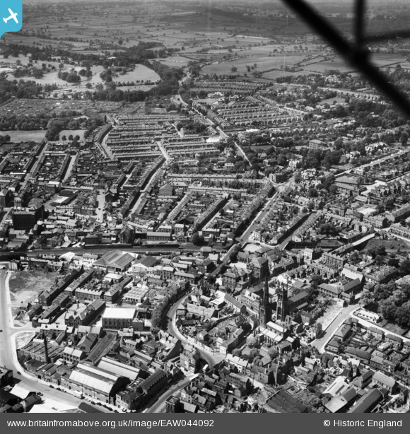
EAW044092 ENGLAND (1952). King Street, Duffield Road and environs, Derby, from the south-east, 1952
© Copyright OpenStreetMap contributors and licensed by the OpenStreetMap Foundation. 2026. Cartography is licensed as CC BY-SA.
Nearby Images (4)
EAW044092

EPW055026

EAW044088

EAW004661

Details
| Title | [EAW044092] King Street, Duffield Road and environs, Derby, from the south-east, 1952 |
| Reference | EAW044092 |
| Date | 10-June-1952 |
| Link | |
| Place name | DERBY |
| Parish | |
| District | |
| Country | ENGLAND |
| Easting / Northing | 435025, 336748 |
| Longitude / Latitude | -1.4789286243134, 52.926680600395 |
| National Grid Reference | SK350367 |
Pins

VG |
Sunday 23rd of July 2023 04:59:10 PM | |
|
VG |
Sunday 23rd of July 2023 04:57:31 PM | |
|
Citled |
Friday 9th of June 2023 05:16:34 PM | |
|
jimexplore |
Monday 3rd of August 2020 09:49:45 AM | |
|
Moz |
Tuesday 16th of June 2020 11:52:40 AM | |
|
John Wass |
Wednesday 5th of October 2016 08:47:25 PM | |

Nick Ashton-Jones |
Sunday 2nd of August 2015 10:07:14 AM | |
|
Nick Ashton-Jones |
Tuesday 2nd of September 2014 11:55:59 AM | |
|
Nick Ashton-Jones |
Tuesday 2nd of September 2014 11:55:19 AM | |

Peter Kazmierczak |
Thursday 3rd of July 2014 08:43:46 PM | |
|
Peter Kazmierczak |
Thursday 3rd of July 2014 08:41:44 PM | |
|
Peter Kazmierczak |
Thursday 3rd of July 2014 08:40:55 PM | |
|
Peter Kazmierczak |
Thursday 3rd of July 2014 08:39:14 PM | |
|
Peter Kazmierczak |
Thursday 3rd of July 2014 08:38:07 PM | |
|
Peter Kazmierczak |
Thursday 3rd of July 2014 08:36:38 PM | |
|
Peter Kazmierczak |
Thursday 3rd of July 2014 08:35:27 PM | |
|
Peter Kazmierczak |
Thursday 3rd of July 2014 08:34:13 PM | |
|
Peter Kazmierczak |
Thursday 3rd of July 2014 08:33:19 PM | |
|
Peter Kazmierczak |
Thursday 3rd of July 2014 08:28:56 PM |