
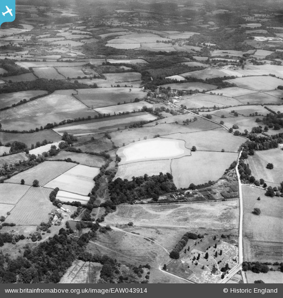
EAW043914 ENGLAND (1952). East Mascalls Farm and the surrounding countryside, East Mascalls, 1952
© Copyright OpenStreetMap contributors and licensed by the OpenStreetMap Foundation. 2026. Cartography is licensed as CC BY-SA.
Nearby Images (2)
EAW043914

EAW043918

Details
| Title | [EAW043914] East Mascalls Farm and the surrounding countryside, East Mascalls, 1952 |
| Reference | EAW043914 |
| Date | 10-June-1952 |
| Link | |
| Place name | EAST MASCALLS |
| Parish | LINDFIELD RURAL |
| District | |
| Country | ENGLAND |
| Easting / Northing | 536140, 125285 |
| Longitude / Latitude | -0.059151849228852, 51.01027419666 |
| National Grid Reference | TQ361253 |
Pins

Matt Aldred edob.mattaldred.com |
Friday 4th of December 2020 09:35:36 PM |