
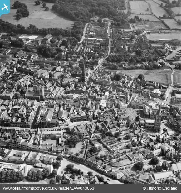
EAW043863 ENGLAND (1952). The town centre, Stamford, 1952
© Copyright OpenStreetMap contributors and licensed by the OpenStreetMap Foundation. 2026. Cartography is licensed as CC BY-SA.
Nearby Images (14)
EAW043863

EAW043861

EPW054985

EAW033042

EAW033041

EPW050308

EAW033043

EAW043859

EAW043862

EAW013391

EAW033044

EPW054982

EAW043860

EAW013392

Details
| Title | [EAW043863] The town centre, Stamford, 1952 |
| Reference | EAW043863 |
| Date | 10-June-1952 |
| Link | |
| Place name | STAMFORD |
| Parish | STAMFORD |
| District | |
| Country | ENGLAND |
| Easting / Northing | 502990, 307102 |
| Longitude / Latitude | -0.47739991595245, 52.65150812404 |
| National Grid Reference | TF030071 |
Pins

John W |
Tuesday 28th of June 2016 05:16:29 PM |