
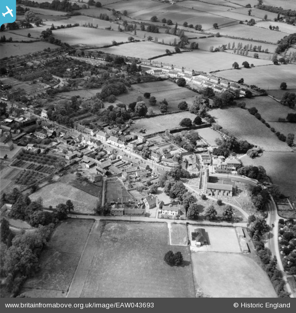
EAW043693 ENGLAND (1952). St Andrew's Church and the High Street, Earls Colne, 1952
© Copyright OpenStreetMap contributors and licensed by the OpenStreetMap Foundation. 2026. Cartography is licensed as CC BY-SA.
Nearby Images (2)
EAW043693

EAW043694

Details
| Title | [EAW043693] St Andrew's Church and the High Street, Earls Colne, 1952 |
| Reference | EAW043693 |
| Date | 4-June-1952 |
| Link | |
| Place name | EARLS COLNE |
| Parish | EARLS COLNE |
| District | |
| Country | ENGLAND |
| Easting / Northing | 585968, 228883 |
| Longitude / Latitude | 0.70500578770221, 51.926917397363 |
| National Grid Reference | TL860289 |
Pins

Matt Aldred edob.mattaldred.com |
Sunday 2nd of March 2025 02:49:16 PM |