
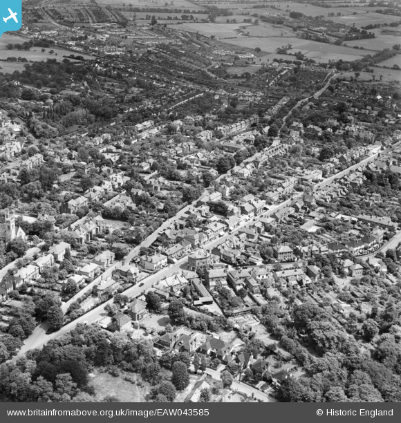
EAW043585 ENGLAND (1952). Westbury Lane, Queen's Road and environs, Buckhurst Hill, 1952
© Copyright OpenStreetMap contributors and licensed by the OpenStreetMap Foundation. 2026. Cartography is licensed as CC BY-SA.
Nearby Images (4)
EAW043585

EAW043586

EAW043587

EPW025436

Details
| Title | [EAW043585] Westbury Lane, Queen's Road and environs, Buckhurst Hill, 1952 |
| Reference | EAW043585 |
| Date | 4-June-1952 |
| Link | |
| Place name | BUCKHURST HILL |
| Parish | BUCKHURST HILL |
| District | |
| Country | ENGLAND |
| Easting / Northing | 541135, 193925 |
| Longitude / Latitude | 0.039191270954904, 51.625948905298 |
| National Grid Reference | TQ411939 |
Pins

Starcross |
Saturday 1st of September 2018 04:58:26 AM |