
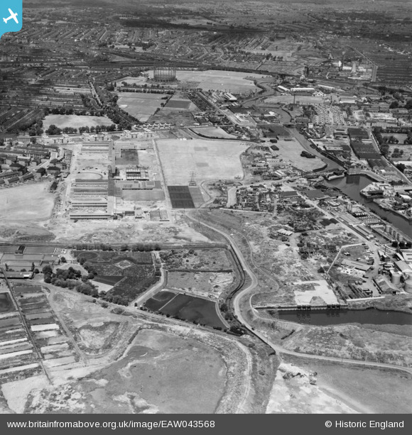
EAW043568 ENGLAND (1952). Wallend, the Great Wharf Estate and environs, East Ham, 1952
© Copyright OpenStreetMap contributors and licensed by the OpenStreetMap Foundation. 2026. Cartography is licensed as CC BY-SA.
Nearby Images (4)
EAW043568

EAW043567

EPW025608

EPW025606

Details
| Title | [EAW043568] Wallend, the Great Wharf Estate and environs, East Ham, 1952 |
| Reference | EAW043568 |
| Date | 4-June-1952 |
| Link | |
| Place name | EAST HAM |
| Parish | |
| District | |
| Country | ENGLAND |
| Easting / Northing | 543750, 183473 |
| Longitude / Latitude | 0.072668826737878, 51.531360113374 |
| National Grid Reference | TQ438835 |
Pins

pl8man |
Sunday 12th of July 2020 02:20:52 PM | |
|
pl8man |
Sunday 12th of July 2020 02:19:54 PM | |
|
pl8man |
Sunday 12th of July 2020 02:18:53 PM | |
|
mel |
Saturday 31st of December 2016 06:00:35 PM |