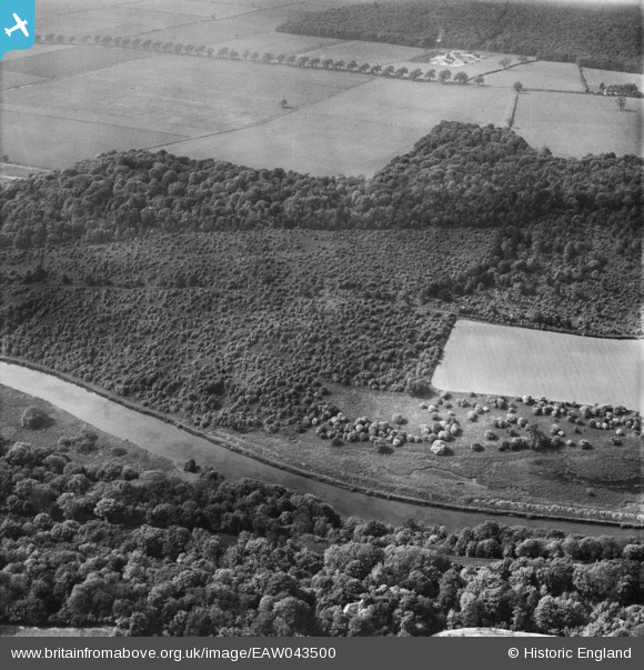
EAW043500 ENGLAND (1952). Pot Ridings Wood, Cadeby, 1952
© Copyright OpenStreetMap contributors and licensed by the OpenStreetMap Foundation. 2025. Cartography is licensed as CC BY-SA.
Nearby Images (6)
Details
| Title | [EAW043500] Pot Ridings Wood, Cadeby, 1952 |
| Reference | EAW043500 |
| Date | 21-May-1952 |
| Link | |
| Place name | CADEBY |
| Parish | CADEBY |
| District | |
| Country | ENGLAND |
| Easting / Northing | 452969, 400457 |
| Longitude / Latitude | -1.2014175302317, 53.497892675951 |
| National Grid Reference | SE530005 |
Pins
Be the first to add a comment to this image!


![[EAW043500] Pot Ridings Wood, Cadeby, 1952](http://britainfromabove.org.uk/sites/all/libraries/aerofilms-images/public/100x100/EAW/043/EAW043500.jpg)
![[EAW047728] Pot Ridings Wood with Sprotbrough Quarry in the distance, Cadeby, from the south, 1952](http://britainfromabove.org.uk/sites/all/libraries/aerofilms-images/public/100x100/EAW/047/EAW047728.jpg)
![[EAW047729] Pot Ridings Wood with Sprotbrough Quarry in the distance, Cadeby, from the south, 1952](http://britainfromabove.org.uk/sites/all/libraries/aerofilms-images/public/100x100/EAW/047/EAW047729.jpg)
![[EAW043501] Pot Ridings Wood, Cadeby, 1952](http://britainfromabove.org.uk/sites/all/libraries/aerofilms-images/public/100x100/EAW/043/EAW043501.jpg)
![[EAW043499] Pot Ridings Wood, Cadeby, 1952](http://britainfromabove.org.uk/sites/all/libraries/aerofilms-images/public/100x100/EAW/043/EAW043499.jpg)
![[EAW047732] Pot Ridings Wood and Sprotbrough Quarry, Cadeby, 1952](http://britainfromabove.org.uk/sites/all/libraries/aerofilms-images/public/100x100/EAW/047/EAW047732.jpg)