
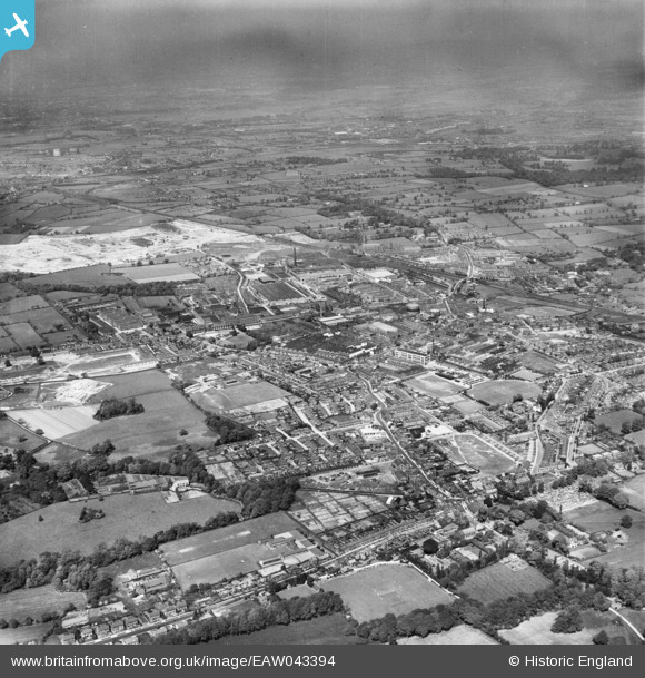
EAW043394 ENGLAND (1952). The town, Leyland, from the south-west, 1952
© Copyright OpenStreetMap contributors and licensed by the OpenStreetMap Foundation. 2026. Cartography is licensed as CC BY-SA.
Nearby Images (2)
EAW043394

EPW026420

Details
| Title | [EAW043394] The town, Leyland, from the south-west, 1952 |
| Reference | EAW043394 |
| Date | 13-May-1952 |
| Link | |
| Place name | LEYLAND |
| Parish | |
| District | |
| Country | ENGLAND |
| Easting / Northing | 353904, 421818 |
| Longitude / Latitude | -2.6981294318344, 53.690546620496 |
| National Grid Reference | SD539218 |
Pins

MR |
Sunday 22nd of January 2023 01:09:38 PM | |
|
AntonyW |
Monday 5th of October 2020 09:37:28 PM | |
|
Ray |
Wednesday 6th of September 2017 09:52:17 AM | |
|
Ray |
Wednesday 6th of September 2017 09:50:37 AM | |
|
Ray |
Wednesday 6th of September 2017 09:49:39 AM | |
|
Ray |
Wednesday 6th of September 2017 09:49:02 AM | |
|
Ray |
Wednesday 6th of September 2017 09:48:23 AM | |
|
Ray |
Wednesday 6th of September 2017 09:47:08 AM | |
|
Ray |
Wednesday 6th of September 2017 09:46:31 AM | |
|
Ray |
Wednesday 6th of September 2017 09:43:57 AM | |
|
Ray |
Wednesday 6th of September 2017 09:42:20 AM | |
|
Ray |
Tuesday 5th of September 2017 02:06:31 PM | |
|
Ray |
Tuesday 5th of September 2017 02:03:10 PM | |
|
Ray |
Wednesday 30th of August 2017 04:50:03 PM | |
|
Ray |
Wednesday 30th of August 2017 04:48:01 PM | |
|
Ray |
Wednesday 30th of August 2017 04:46:49 PM | |
|
Ray |
Wednesday 30th of August 2017 04:46:13 PM | |
|
Ray |
Wednesday 30th of August 2017 04:44:51 PM | |
|
Ray |
Wednesday 30th of August 2017 11:54:19 AM | |
|
Ray |
Wednesday 30th of August 2017 11:53:42 AM | |
|
Ray |
Wednesday 30th of August 2017 11:46:05 AM | |
|
Ray |
Wednesday 30th of August 2017 11:44:16 AM | |
|
Ray |
Wednesday 30th of August 2017 11:43:38 AM | |
|
Ray |
Wednesday 30th of August 2017 11:41:56 AM | |
|
Ray |
Wednesday 30th of August 2017 11:40:55 AM | |
|
Ray |
Wednesday 30th of August 2017 11:39:40 AM | |
|
Ray |
Wednesday 30th of August 2017 11:38:12 AM | |
|
Ray |
Wednesday 30th of August 2017 11:37:44 AM | |
|
Ray |
Wednesday 30th of August 2017 11:36:40 AM | |
|
Ray |
Wednesday 30th of August 2017 11:35:45 AM | |
|
Ray |
Wednesday 30th of August 2017 11:34:40 AM | |
|
Ray |
Wednesday 30th of August 2017 11:32:38 AM | |
|
Ray |
Wednesday 30th of August 2017 11:31:59 AM | |
|
Ray |
Wednesday 30th of August 2017 11:31:09 AM | |
|
Ray |
Wednesday 30th of August 2017 11:30:37 AM | |
|
Ray |
Wednesday 30th of August 2017 11:29:50 AM | |
|
Ray |
Wednesday 30th of August 2017 11:29:20 AM | |
|
Ray |
Wednesday 30th of August 2017 11:28:43 AM | |
|
Ray |
Wednesday 30th of August 2017 11:27:54 AM | |
|
Ray |
Wednesday 30th of August 2017 11:27:15 AM | |
|
Ray |
Wednesday 30th of August 2017 11:26:44 AM | |
|
Ray |
Wednesday 30th of August 2017 11:26:14 AM | |
|
Neil Linford |
Sunday 26th of July 2015 06:29:59 PM | |
|
Neil Linford |
Sunday 26th of July 2015 06:26:27 PM | |
|
Neil Linford |
Sunday 26th of July 2015 06:25:26 PM | |
|
Neil Linford |
Sunday 26th of July 2015 06:22:52 PM | |
|
Neil Linford |
Saturday 25th of July 2015 11:48:31 AM | |
|
Neil Linford |
Saturday 25th of July 2015 11:46:48 AM | |
|
Neil Linford |
Saturday 25th of July 2015 11:44:26 AM | |
|
Neil Linford |
Saturday 25th of July 2015 11:43:19 AM | |
|
Neil Linford |
Saturday 25th of July 2015 11:42:36 AM |