
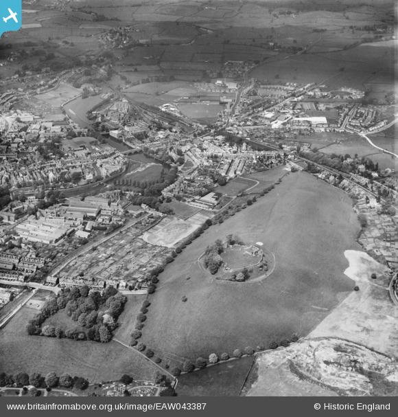
EAW043387 ENGLAND (1952). Kendal Castle overlooking the town, Kendal, 1952
© Copyright OpenStreetMap contributors and licensed by the OpenStreetMap Foundation. 2026. Cartography is licensed as CC BY-SA.
Nearby Images (16)
EAW043387

EAW043388

EPW026753

EPW026747

EPW026756

EPW026755

EPW026751

EPW026752

EPW026749

EPW026748

EPW026750

EPW026754

EPW026548

EPW026746

EPW026579

EPW026544

Details
| Title | [EAW043387] Kendal Castle overlooking the town, Kendal, 1952 |
| Reference | EAW043387 |
| Date | 13-May-1952 |
| Link | |
| Place name | KENDAL |
| Parish | KENDAL |
| District | |
| Country | ENGLAND |
| Easting / Northing | 352078, 492710 |
| Longitude / Latitude | -2.7369551950356, 54.327556995615 |
| National Grid Reference | SD521927 |
Pins
Be the first to add a comment to this image!