
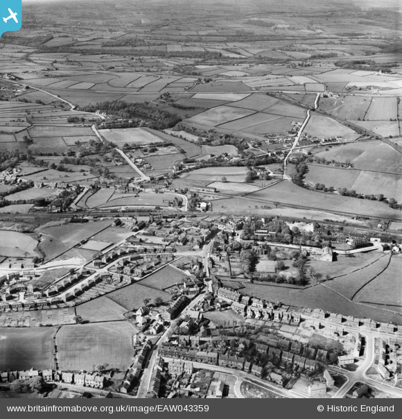
EAW043359 ENGLAND (1952). The town, Penistone, from the south, 1952
© Copyright OpenStreetMap contributors and licensed by the OpenStreetMap Foundation. 2026. Cartography is licensed as CC BY-SA.
Nearby Images (4)
EAW043359

EPW016276

EPW016278

EPW016279

Details
| Title | [EAW043359] The town, Penistone, from the south, 1952 |
| Reference | EAW043359 |
| Date | 16-May-1952 |
| Link | |
| Place name | PENISTONE |
| Parish | PENISTONE |
| District | |
| Country | ENGLAND |
| Easting / Northing | 424577, 403147 |
| Longitude / Latitude | -1.6292405159376, 53.524166958494 |
| National Grid Reference | SE246031 |
Pins

John Wass |
Thursday 25th of June 2020 08:03:09 PM | |
|
John Wass |
Tuesday 19th of June 2018 07:54:03 PM | |
|
stardelta |
Friday 20th of June 2014 06:50:09 PM | |
|
stardelta |
Friday 20th of June 2014 06:48:41 PM |