
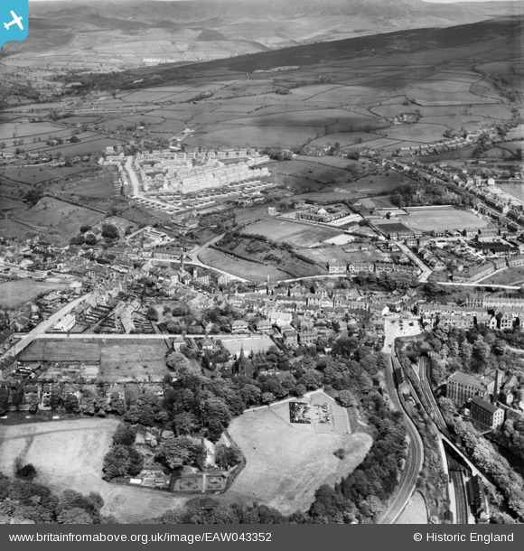
EAW043352 ENGLAND (1952). The town, New Mills, from the south-west, 1952
© Copyright OpenStreetMap contributors and licensed by the OpenStreetMap Foundation. 2026. Cartography is licensed as CC BY-SA.
Nearby Images (4)
EAW043352

EAW043353

EAW043351

EAW002158

Details
| Title | [EAW043352] The town, New Mills, from the south-west, 1952 |
| Reference | EAW043352 |
| Date | 16-May-1952 |
| Link | |
| Place name | NEW MILLS |
| Parish | NEW MILLS |
| District | |
| Country | ENGLAND |
| Easting / Northing | 399802, 385503 |
| Longitude / Latitude | -2.0029758834051, 53.366130208762 |
| National Grid Reference | SJ998855 |
Pins

Mark |
Wednesday 19th of February 2020 04:14:12 PM | |
|
Mark |
Wednesday 19th of February 2020 04:12:30 PM | |
|
ianscarb |
Friday 14th of November 2014 10:15:31 PM | |
|
ianscarb |
Friday 14th of November 2014 10:13:47 PM | |
|
ianscarb |
Friday 14th of November 2014 10:12:20 PM |
User Comment Contributions
I was born in New Mills in 1955 and remember the railways very well. Particulary the New mills central station branch line to Hayfield. we lived just 50yds away from the line near New Mills Tunnel End signal box, indeed, my father was signalman there for a while before moving on to Central Station box. |
Glyn |
Monday 26th of January 2015 08:00:04 PM |