
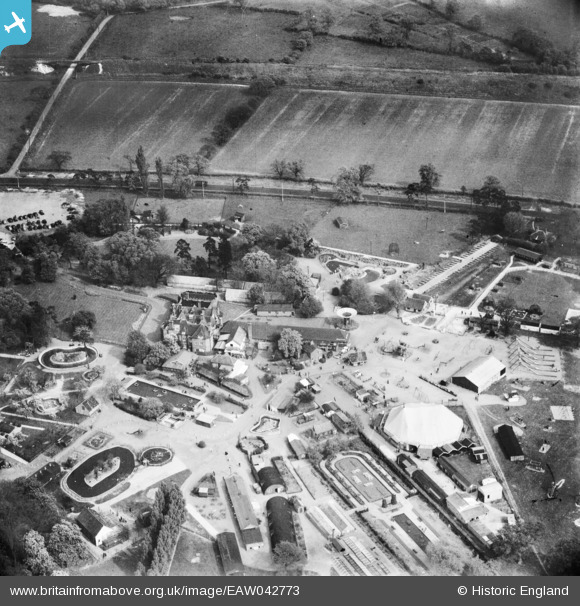
EAW042773 ENGLAND (1952). Chessington Zoo, Chessington, 1952
© Copyright OpenStreetMap contributors and licensed by the OpenStreetMap Foundation. 2026. Cartography is licensed as CC BY-SA.
Nearby Images (5)
EAW042773

EAW023697

EAW023696

EAW023695

EAW042774

Details
| Title | [EAW042773] Chessington Zoo, Chessington, 1952 |
| Reference | EAW042773 |
| Date | 29-April-1952 |
| Link | |
| Place name | CHESSINGTON |
| Parish | |
| District | |
| Country | ENGLAND |
| Easting / Northing | 517386, 162387 |
| Longitude / Latitude | -0.31425821670516, 51.347923256367 |
| National Grid Reference | TQ174624 |
Pins

John Wass |
Friday 19th of December 2014 08:04:00 PM | |
|
John Wass |
Friday 19th of December 2014 08:03:25 PM |