
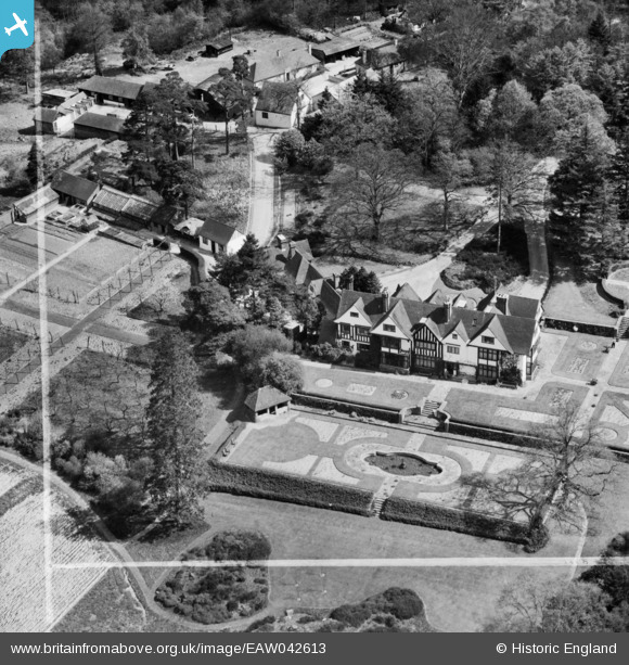
EAW042613 ENGLAND (1952). Gotwick Manor, Hammerwood, 1952. This image was marked by Aerofilms Ltd for photo editing.
© Copyright OpenStreetMap contributors and licensed by the OpenStreetMap Foundation. 2025. Cartography is licensed as CC BY-SA.
Nearby Images (11)
EAW042613

EAW042614

EAW042609

EAW042610

EAW042612

EAW042615

EAW042619

EAW042611

EAW042618

EAW042617

EAW042616

Details
| Title | [EAW042613] Gotwick Manor, Hammerwood, 1952. This image was marked by Aerofilms Ltd for photo editing. |
| Reference | EAW042613 |
| Date | 22-April-1952 |
| Link | |
| Place name | HAMMERWOOD |
| Parish | FOREST ROW |
| District | |
| Country | ENGLAND |
| Easting / Northing | 542956, 139781 |
| Longitude / Latitude | 0.043687580959515, 51.138902370694 |
| National Grid Reference | TQ430398 |
Pins
Be the first to add a comment to this image!