
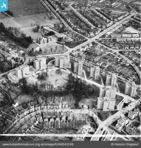
EAW042248 ENGLAND (1952). The Springfield Housing Estate, Charlton, 1952. This image was marked by Aerofilms Ltd for photo editing.
© Copyright OpenStreetMap contributors and licensed by the OpenStreetMap Foundation. 2026. Cartography is licensed as CC BY-SA.
Nearby Images (12)
EAW042248

EAW042241

EAW042250

EAW042243

EAW042245

EAW042242

EAW042249

EAW042247

EAW042246

EAW042244

EAW005424

EAW005426

Details
| Title | [EAW042248] The Springfield Housing Estate, Charlton, 1952. This image was marked by Aerofilms Ltd for photo editing. |
| Reference | EAW042248 |
| Date | 7-April-1952 |
| Link | |
| Place name | CHARLTON |
| Parish | |
| District | |
| Country | ENGLAND |
| Easting / Northing | 541389, 177704 |
| Longitude / Latitude | 0.036336716788342, 51.480111498087 |
| National Grid Reference | TQ414777 |
Pins

Cherry Orchard |
Friday 10th of June 2016 03:02:49 PM | |
|
Cherry Orchard |
Friday 10th of June 2016 03:01:21 PM |