
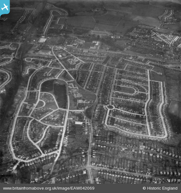
EAW042069 ENGLAND (1952). Housing estates at Poverest, Orpington, 1952
© Copyright OpenStreetMap contributors and licensed by the OpenStreetMap Foundation. 2026. Cartography is licensed as CC BY-SA.
Nearby Images (4)
EAW042069

EAW042067

EAW042071

EAW042070

Details
| Title | [EAW042069] Housing estates at Poverest, Orpington, 1952 |
| Reference | EAW042069 |
| Date | March-1952 |
| Link | |
| Place name | ORPINGTON |
| Parish | |
| District | |
| Country | ENGLAND |
| Easting / Northing | 546203, 167806 |
| Longitude / Latitude | 0.10153311764201, 51.389938747105 |
| National Grid Reference | TQ462678 |
Pins

John |
Friday 3rd of February 2017 09:19:10 AM | |
|
John |
Friday 3rd of February 2017 09:18:42 AM | |
|
John |
Friday 3rd of February 2017 09:15:05 AM | |
|
John |
Thursday 2nd of February 2017 11:33:36 PM | |
|
Buzby9 |
Wednesday 2nd of December 2015 10:05:17 AM | |
|
Buzby9 |
Saturday 26th of April 2014 12:42:14 PM | |
|
Buzby9 |
Saturday 26th of April 2014 12:38:47 PM | |
|
Mike Floate |
Friday 25th of April 2014 06:14:33 PM | |
|
Mike Floate |
Friday 25th of April 2014 06:13:34 PM | |
|
Mike Floate |
Friday 25th of April 2014 05:28:50 PM | |
|
Mike Floate |
Friday 25th of April 2014 05:28:02 PM | |
|
Mike Floate |
Friday 25th of April 2014 05:26:38 PM | |
|
Mike Floate |
Friday 25th of April 2014 05:25:31 PM |
