
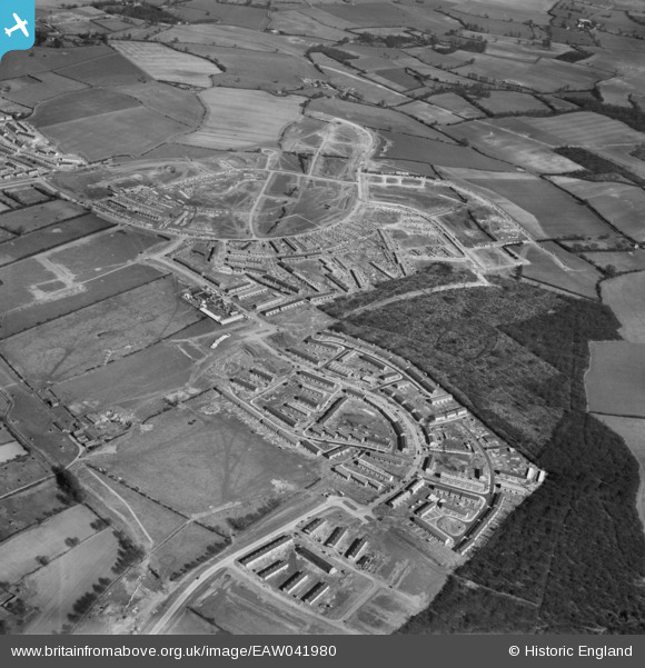
EAW041980 ENGLAND (1952). Development of Bedwell and Monkswood, Stevenage, 1952
© Copyright OpenStreetMap contributors and licensed by the OpenStreetMap Foundation. 2026. Cartography is licensed as CC BY-SA.
Nearby Images (8)
EAW041980

EAW041985

EAW047262

EAW047263

EAW047261

EAW047265

EAW047269

EAW047260

Details
| Title | [EAW041980] Development of Bedwell and Monkswood, Stevenage, 1952 |
| Reference | EAW041980 |
| Date | 14-March-1952 |
| Link | |
| Place name | STEVENAGE |
| Parish | |
| District | |
| Country | ENGLAND |
| Easting / Northing | 524539, 223827 |
| Longitude / Latitude | -0.189739914218, 51.898615907473 |
| National Grid Reference | TL245238 |
Pins

andy |
Monday 22nd of July 2019 05:30:08 PM | |
|
andy |
Monday 22nd of July 2019 05:27:05 PM | |
|
andy |
Monday 22nd of July 2019 05:21:59 PM | |
|
andy |
Monday 22nd of July 2019 05:21:07 PM | |
|
andy |
Monday 22nd of July 2019 05:19:13 PM | |
|
andy |
Monday 22nd of July 2019 05:18:18 PM | |
|
andy |
Monday 22nd of July 2019 05:17:40 PM | |
|
andy |
Monday 22nd of July 2019 05:16:46 PM | |
|
andy |
Monday 22nd of July 2019 05:15:36 PM | |
|
andy |
Monday 22nd of July 2019 05:13:51 PM | |
|
andy |
Monday 22nd of July 2019 05:13:08 PM | |
|
andy |
Monday 22nd of July 2019 05:10:56 PM |