
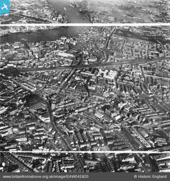
EAW041820 ENGLAND (1952). Grange Road and environs, Bermondsey, 1952. This image has been produced from a print marked by Aerofilms Ltd for photo editing.
© Copyright OpenStreetMap contributors and licensed by the OpenStreetMap Foundation. 2026. Cartography is licensed as CC BY-SA.
Nearby Images (15)
EAW041820

EAW041823

EAW041817

EAW041818

EAW041821

EAW041815

EAW041816

EAW041824

EAW041826

EAW041813

EAW041819

EPW055345

EAW021722

EAW041822

EAW041814

Details
| Title | [EAW041820] Grange Road and environs, Bermondsey, 1952. This image has been produced from a print marked by Aerofilms Ltd for photo editing. |
| Reference | EAW041820 |
| Date | 5-March-1952 |
| Link | |
| Place name | BERMONDSEY |
| Parish | |
| District | |
| Country | ENGLAND |
| Easting / Northing | 533644, 179291 |
| Longitude / Latitude | -0.074539067260289, 51.496257878258 |
| National Grid Reference | TQ336793 |
