
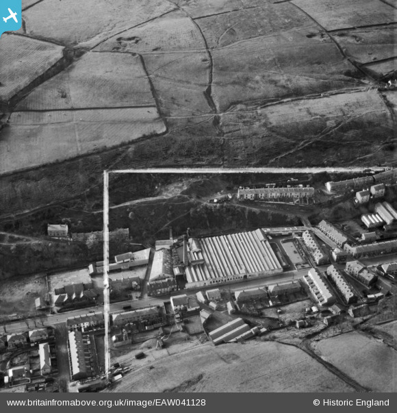
EAW041128 ENGLAND (1951). Osborne Mill, Whitewell Bottom, 1951. This image was marked by Aerofilms Ltd for photo editing.
© Copyright OpenStreetMap contributors and licensed by the OpenStreetMap Foundation. 2025. Cartography is licensed as CC BY-SA.
Nearby Images (16)
EAW041128

EAW041129

EAW039805

EAW039803

EAW041123

EAW039804

EAW041122

EAW039808

EAW041125

EAW039809

EAW041126

EAW039806

EAW041127

EAW039807

EAW041124

EAW039810

Details
| Title | [EAW041128] Osborne Mill, Whitewell Bottom, 1951. This image was marked by Aerofilms Ltd for photo editing. |
| Reference | EAW041128 |
| Date | 31-October-1951 |
| Link | |
| Place name | WHITEWELL BOTTOM |
| Parish | |
| District | |
| Country | ENGLAND |
| Easting / Northing | 383457, 423782 |
| Longitude / Latitude | -2.2506595063064, 53.709973456444 |
| National Grid Reference | SD835238 |
Pins
Be the first to add a comment to this image!