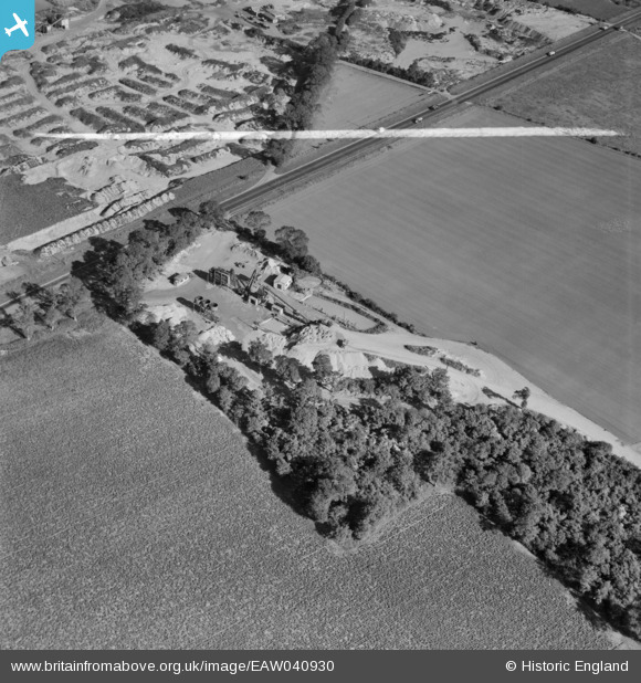
EAW040930 ENGLAND (1951). Gravel Pits off Arterial Road West Thurrock, West Thurrock, 1951. This image was marked by Aerofilms Ltd for photo editing.
© Copyright OpenStreetMap contributors and licensed by the OpenStreetMap Foundation. 2025. Cartography is licensed as CC BY-SA.
Nearby Images (10)
Details
| Title | [EAW040930] Gravel Pits off Arterial Road West Thurrock, West Thurrock, 1951. This image was marked by Aerofilms Ltd for photo editing. |
| Reference | EAW040930 |
| Date | 17-October-1951 |
| Link | |
| Place name | WEST THURROCK |
| Parish | |
| District | |
| Country | ENGLAND |
| Easting / Northing | 558483, 179223 |
| Longitude / Latitude | 0.28301388516843, 51.489228907393 |
| National Grid Reference | TQ585792 |
Pins
Be the first to add a comment to this image!


![[EAW040930] Gravel Pits off Arterial Road West Thurrock, West Thurrock, 1951. This image was marked by Aerofilms Ltd for photo editing.](http://britainfromabove.org.uk/sites/all/libraries/aerofilms-images/public/100x100/EAW/040/EAW040930.jpg)
![[EAW040933] Gravel Pits off Arterial Road West Thurrock, West Thurrock, 1951. This image was marked by Aerofilms Ltd for photo editing.](http://britainfromabove.org.uk/sites/all/libraries/aerofilms-images/public/100x100/EAW/040/EAW040933.jpg)
![[EAW040937] Gravel Pits off Arterial Road West Thurrock, West Thurrock, 1951. This image was marked by Aerofilms Ltd for photo editing.](http://britainfromabove.org.uk/sites/all/libraries/aerofilms-images/public/100x100/EAW/040/EAW040937.jpg)
![[EAW040935] Gravel Pits off Arterial Road West Thurrock, West Thurrock, 1951. This image was marked by Aerofilms Ltd for photo editing.](http://britainfromabove.org.uk/sites/all/libraries/aerofilms-images/public/100x100/EAW/040/EAW040935.jpg)
![[EAW040931] Gravel Pit adjacent to Nine Acre Shaw, West Thurrock, 1951. This image was marked by Aerofilms Ltd for photo editing.](http://britainfromabove.org.uk/sites/all/libraries/aerofilms-images/public/100x100/EAW/040/EAW040931.jpg)
![[EAW040936] Gravel Pits off Arterial Road West Thurrock, West Thurrock, 1951. This image was marked by Aerofilms Ltd for photo editing.](http://britainfromabove.org.uk/sites/all/libraries/aerofilms-images/public/100x100/EAW/040/EAW040936.jpg)
![[EAW040938] Gravel Pits off Arterial Road West Thurrock, West Thurrock, 1951. This image was marked by Aerofilms Ltd for photo editing.](http://britainfromabove.org.uk/sites/all/libraries/aerofilms-images/public/100x100/EAW/040/EAW040938.jpg)
![[EAW040934] Gravel Pits off Arterial Road West Thurrock, West Thurrock, 1951. This image was marked by Aerofilms Ltd for photo editing.](http://britainfromabove.org.uk/sites/all/libraries/aerofilms-images/public/100x100/EAW/040/EAW040934.jpg)
![[EAW040939] Gravel Pit adjacent to Nine Acre Shaw, West Thurrock, 1951. This image was marked by Aerofilms Ltd for photo editing.](http://britainfromabove.org.uk/sites/all/libraries/aerofilms-images/public/100x100/EAW/040/EAW040939.jpg)
![[EAW040932] Gravel Pit adjacent to Nine Acre Shaw, West Thurrock, 1951. This image was marked by Aerofilms Ltd for photo editing.](http://britainfromabove.org.uk/sites/all/libraries/aerofilms-images/public/100x100/EAW/040/EAW040932.jpg)