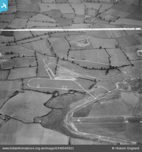
EAW040911 ENGLAND (1951). The Birch Pit (sand and gravel) alongside Birch Airfield, Birch, 1951. This image was marked by Aerofilms Ltd for photo editing.
© Copyright OpenStreetMap contributors and licensed by the OpenStreetMap Foundation. 2026. Cartography is licensed as CC BY-SA.
Nearby Images (9)
Details
| Title | [EAW040911] The Birch Pit (sand and gravel) alongside Birch Airfield, Birch, 1951. This image was marked by Aerofilms Ltd for photo editing. |
| Reference | EAW040911 |
| Date | 18-October-1951 |
| Link | |
| Place name | BIRCH |
| Parish | BIRCH |
| District | |
| Country | ENGLAND |
| Easting / Northing | 592742, 219819 |
| Longitude / Latitude | 0.79834876224534, 51.843208049207 |
| National Grid Reference | TL927198 |


![[EAW040911] The Birch Pit (sand and gravel) alongside Birch Airfield, Birch, 1951. This image was marked by Aerofilms Ltd for photo editing.](http://britainfromabove.org.uk/sites/all/libraries/aerofilms-images/public/100x100/EAW/040/EAW040911.jpg)
![[EAW040908] The Birch Pit (sand and gravel) alongside Birch Airfield, Birch, 1951. This image was marked by Aerofilms Ltd for photo editing.](http://britainfromabove.org.uk/sites/all/libraries/aerofilms-images/public/100x100/EAW/040/EAW040908.jpg)
![[EAW040909] The Birch Pit (sand and gravel) alongside Birch Airfield, Birch, 1951. This image was marked by Aerofilms Ltd for photo editing.](http://britainfromabove.org.uk/sites/all/libraries/aerofilms-images/public/100x100/EAW/040/EAW040909.jpg)
![[EAW040912] The Birch Pit (sand and gravel) alongside Birch Airfield, Birch, 1951. This image was marked by Aerofilms Ltd for photo editing.](http://britainfromabove.org.uk/sites/all/libraries/aerofilms-images/public/100x100/EAW/040/EAW040912.jpg)
![[EAW040910] The Birch Pit (sand and gravel) alongside Birch Airfield, Birch, 1951. This image was marked by Aerofilms Ltd for photo editing.](http://britainfromabove.org.uk/sites/all/libraries/aerofilms-images/public/100x100/EAW/040/EAW040910.jpg)
![[EAW041053] Birch Gravel Pit by Roundbush Corner and Birch Airfield, Birch, 1951. This image was marked by Aerofilms Ltd for photo editing.](http://britainfromabove.org.uk/sites/all/libraries/aerofilms-images/public/100x100/EAW/041/EAW041053.jpg)
![[EAW041054] Birch Gravel Pit by Roundbush Corner and Birch Airfield, Birch, 1951. This image was marked by Aerofilms Ltd for photo editing.](http://britainfromabove.org.uk/sites/all/libraries/aerofilms-images/public/100x100/EAW/041/EAW041054.jpg)
![[EAW041056] Birch Gravel Pit by Roundbush Corner and Birch Airfield, Birch, 1951. This image was marked by Aerofilms Ltd for photo editing.](http://britainfromabove.org.uk/sites/all/libraries/aerofilms-images/public/100x100/EAW/041/EAW041056.jpg)
![[EAW041055] Birch Gravel Pit by Roundbush Corner and Birch Airfield, Birch, 1951. This image was marked by Aerofilms Ltd for photo editing.](http://britainfromabove.org.uk/sites/all/libraries/aerofilms-images/public/100x100/EAW/041/EAW041055.jpg)
