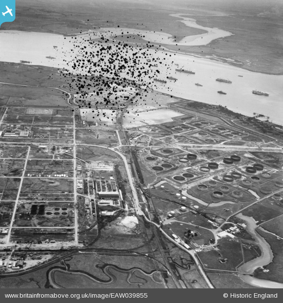
EAW039855 ENGLAND (1951). The Anglo-Iranian Oil Co oil refinery under construction, Isle of Grain, from the north-west, 1951. This image has been produced from a damaged negative.
© Copyright OpenStreetMap contributors and licensed by the OpenStreetMap Foundation. 2026. Cartography is licensed as CC BY-SA.
Details
| Title | [EAW039855] The Anglo-Iranian Oil Co oil refinery under construction, Isle of Grain, from the north-west, 1951. This image has been produced from a damaged negative. |
| Reference | EAW039855 |
| Date | 20-August-1951 |
| Link | |
| Place name | ISLE OF GRAIN |
| Parish | ISLE OF GRAIN |
| District | |
| Country | ENGLAND |
| Easting / Northing | 586327, 175351 |
| Longitude / Latitude | 0.68163972940077, 51.445959055394 |
| National Grid Reference | TQ863754 |


![[EAW039855] The Anglo-Iranian Oil Co oil refinery under construction, Isle of Grain, from the north-west, 1951. This image has been produced from a damaged negative.](http://britainfromabove.org.uk/sites/all/libraries/aerofilms-images/public/100x100/EAW/039/EAW039855.jpg)
![[EPW013202] The Medway Oil Storage Company Ltd, Isle of Grain, 1925](http://britainfromabove.org.uk/sites/all/libraries/aerofilms-images/public/100x100/EPW/013/EPW013202.jpg)
