
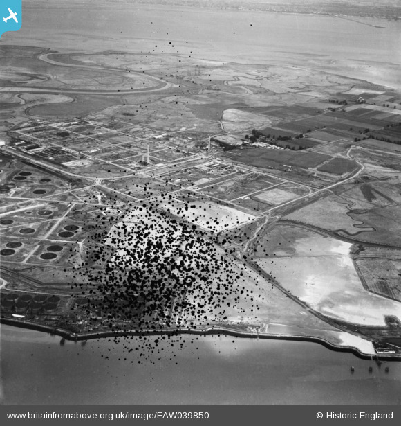
EAW039850 ENGLAND (1951). The Anglo-Iranian Oil Co oil refinery under construction, Isle of Grain, from the south, 1951. This image has been produced from a damaged negative.
© Copyright OpenStreetMap contributors and licensed by the OpenStreetMap Foundation. 2026. Cartography is licensed as CC BY-SA.
Nearby Images (3)
EAW039850

EAW039851

EAW048521

Details
| Title | [EAW039850] The Anglo-Iranian Oil Co oil refinery under construction, Isle of Grain, from the south, 1951. This image has been produced from a damaged negative. |
| Reference | EAW039850 |
| Date | 20-August-1951 |
| Link | |
| Place name | ISLE OF GRAIN |
| Parish | ISLE OF GRAIN |
| District | |
| Country | ENGLAND |
| Easting / Northing | 587409, 173960 |
| Longitude / Latitude | 0.69645712442182, 51.433107185268 |
| National Grid Reference | TQ874740 |
Pins

redmist |
Sunday 21st of June 2020 10:42:05 PM | |
|
redmist |
Sunday 21st of June 2020 10:38:42 PM |