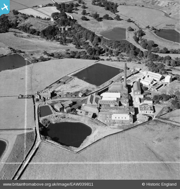
EAW039811 ENGLAND (1951). Springfield Bleach Works, Sharples, 1951.This image was marked by Aerofilms Ltd for photo editing.
© Copyright OpenStreetMap contributors and licensed by the OpenStreetMap Foundation. 2026. Cartography is licensed as CC BY-SA.
Nearby Images (7)
Details
| Title | [EAW039811] Springfield Bleach Works, Sharples, 1951.This image was marked by Aerofilms Ltd for photo editing. |
| Reference | EAW039811 |
| Date | 15-September-1951 |
| Link | |
| Place name | SHARPLES |
| Parish | |
| District | |
| Country | ENGLAND |
| Easting / Northing | 370863, 413266 |
| Longitude / Latitude | -2.4404921265452, 53.614894497965 |
| National Grid Reference | SD709133 |
Pins

thomasknight |
Friday 27th of March 2015 10:40:22 PM |


![[EAW039811] Springfield Bleach Works, Sharples, 1951.This image was marked by Aerofilms Ltd for photo editing.](http://britainfromabove.org.uk/sites/all/libraries/aerofilms-images/public/100x100/EAW/039/EAW039811.jpg)
![[EAW039814] Springfield Bleach Works, Sharples, 1951.This image was marked by Aerofilms Ltd for photo editing.](http://britainfromabove.org.uk/sites/all/libraries/aerofilms-images/public/100x100/EAW/039/EAW039814.jpg)
![[EAW039815] Springfield Bleach Works, Sharples, 1951.This image was marked by Aerofilms Ltd for photo editing.](http://britainfromabove.org.uk/sites/all/libraries/aerofilms-images/public/100x100/EAW/039/EAW039815.jpg)
![[EAW039812] Springfield Bleach Works, Sharples, 1951.This image was marked by Aerofilms Ltd for photo editing.](http://britainfromabove.org.uk/sites/all/libraries/aerofilms-images/public/100x100/EAW/039/EAW039812.jpg)
![[EAW039817] Springfield Bleach Works, Sharples, 1951.This image was marked by Aerofilms Ltd for photo editing.](http://britainfromabove.org.uk/sites/all/libraries/aerofilms-images/public/100x100/EAW/039/EAW039817.jpg)
![[EAW039816] Springfield Bleach Works, Sharples, 1951.This image was marked by Aerofilms Ltd for photo editing.](http://britainfromabove.org.uk/sites/all/libraries/aerofilms-images/public/100x100/EAW/039/EAW039816.jpg)
![[EAW039813] Springfield Bleach Works, Sharples, 1951.This image was marked by Aerofilms Ltd for photo editing.](http://britainfromabove.org.uk/sites/all/libraries/aerofilms-images/public/100x100/EAW/039/EAW039813.jpg)