
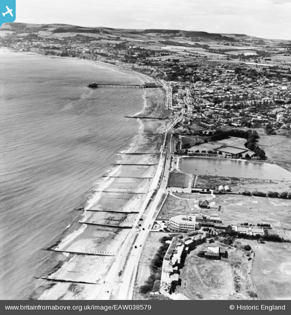
EAW038579 ENGLAND (1951). Sandown Zoo, the seafront and the town, Sandown, from the north-east, 1951. This image has been produced from a print.
© Copyright OpenStreetMap contributors and licensed by the OpenStreetMap Foundation. 2026. Cartography is licensed as CC BY-SA.
Details
| Title | [EAW038579] Sandown Zoo, the seafront and the town, Sandown, from the north-east, 1951. This image has been produced from a print. |
| Reference | EAW038579 |
| Date | 13-August-1951 |
| Link | |
| Place name | SANDOWN |
| Parish | SANDOWN |
| District | |
| Country | ENGLAND |
| Easting / Northing | 460786, 84728 |
| Longitude / Latitude | -1.1399366370696, 50.658471260884 |
| National Grid Reference | SZ608847 |
Pins

SteveB |
Friday 7th of February 2025 10:33:56 AM | |
|
SteveB |
Friday 7th of February 2025 10:33:06 AM | |

Matt Aldred edob.mattaldred.com |
Thursday 3rd of December 2020 09:26:24 PM | |
|
Kentishman |
Thursday 13th of August 2015 04:08:00 PM | |
|
Kentishman |
Thursday 13th of August 2015 03:51:03 PM | |
|
Kentishman |
Thursday 13th of August 2015 03:45:55 PM | |
|
Kentishman |
Thursday 13th of August 2015 03:42:52 PM |


User Comment Contributions

In the foreground are Sandown Granite Fort, the Grand Hotel and the dummy ice cream parlour which were all part of the PLUTO line supplying fuel for the liberation of France in 1944. See also image EAW022216. |
Kentishman |
Thursday 13th of August 2015 03:55:18 PM |