
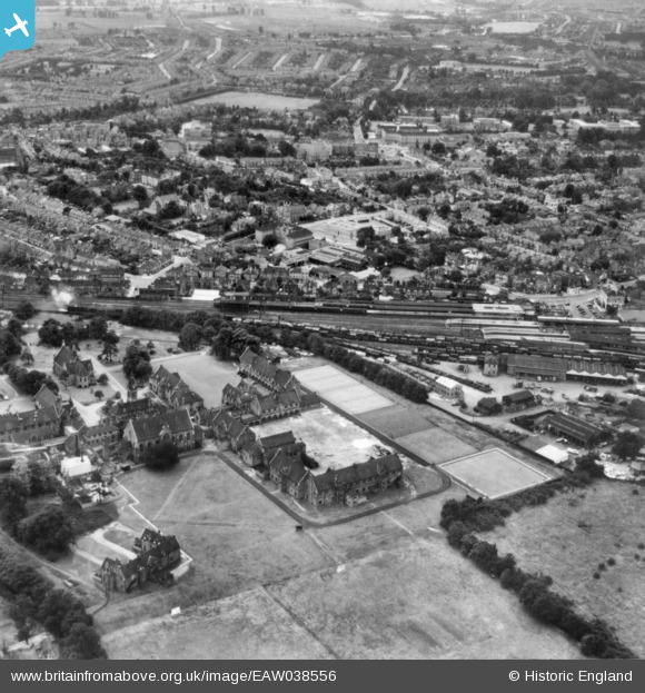
EAW038556 ENGLAND (1951). Government Offices in the former London Orphan School (Reed's School) premises and Watford Junction Railway Station, Watford, 1951. This image has been produced from a copy-negative.
© Copyright OpenStreetMap contributors and licensed by the OpenStreetMap Foundation. 2026. Cartography is licensed as CC BY-SA.
Nearby Images (13)
EAW038556
 premises and Watford Junction Railway Station, Watford, 1951. This image has been produced from a copy-negative.")
EPW006198
, Watford, 1921")
EPW060249

EAW038560

EPW060248

EPR000490

EPR000492

EAW048390

EPR000493

EAW048381

EPR000491

EAW048783
 and North Watford, Watford, from the south-east, 1953")
EPW037384

Details
| Title | [EAW038556] Government Offices in the former London Orphan School (Reed's School) premises and Watford Junction Railway Station, Watford, 1951. This image has been produced from a copy-negative. |
| Reference | EAW038556 |
| Date | 10-August-1951 |
| Link | |
| Place name | WATFORD |
| Parish | |
| District | |
| Country | ENGLAND |
| Easting / Northing | 511160, 197281 |
| Longitude / Latitude | -0.39262823293958, 51.662836923985 |
| National Grid Reference | TQ112973 |
