
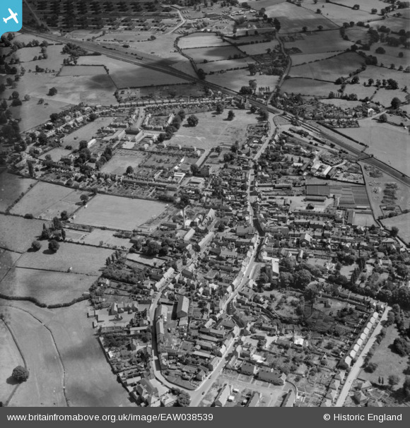
EAW038539 ENGLAND (1951). The High Street and the town centre, Wem, 1951
© Copyright OpenStreetMap contributors and licensed by the OpenStreetMap Foundation. 2026. Cartography is licensed as CC BY-SA.
Nearby Images (4)
EAW038539

EAW038538

EPW058402

EPW058401

Details
| Title | [EAW038539] The High Street and the town centre, Wem, 1951 |
| Reference | EAW038539 |
| Date | 1-August-1951 |
| Link | |
| Place name | WEM |
| Parish | WEM URBAN |
| District | |
| Country | ENGLAND |
| Easting / Northing | 351375, 329018 |
| Longitude / Latitude | -2.7222291793117, 52.856131075084 |
| National Grid Reference | SJ514290 |
Pins

Lucy G |
Sunday 25th of January 2026 07:08:26 PM | |

Matt Aldred edob.mattaldred.com |
Friday 22nd of July 2022 10:17:41 AM | |
|
Stu Giles |
Thursday 17th of May 2018 05:12:31 PM | |
|
totoro |
Friday 28th of November 2014 09:46:02 PM | |
|
totoro |
Friday 28th of November 2014 09:44:13 PM |