
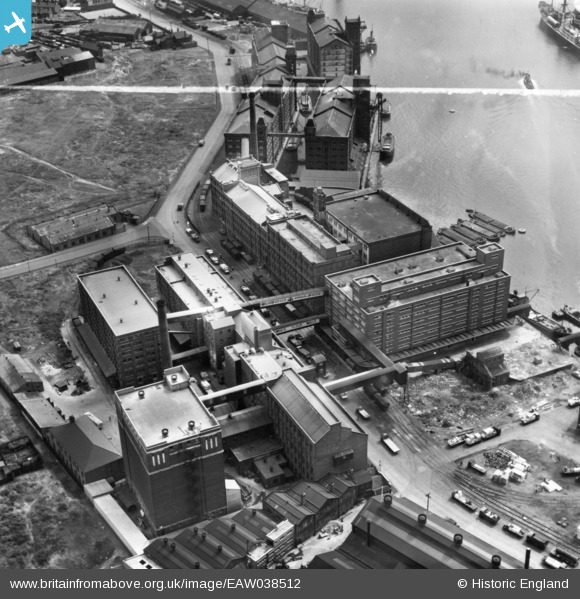
EAW038512 ENGLAND (1951). Buchanan's Flour Mill and the Homepride Flour Mills, Seacombe, 1951. This image has been produced from a print marked by Aerofilms Ltd for photo editing.
© Copyright OpenStreetMap contributors and licensed by the OpenStreetMap Foundation. 2026. Cartography is licensed as CC BY-SA.
Nearby Images (21)
EAW038512

EAW036042

EAW036043

EAW036041

EAW038513

EAW038518

EAW038519

EAW036040

EAW036047

EAW038514

EAW036044

EAW036046

EAW036039

EAW038510

EAW036045

EAW038516

EAW036038

EAW038511

EAW038509

EAW038517

EAW038515

Details
| Title | [EAW038512] Buchanan's Flour Mill and the Homepride Flour Mills, Seacombe, 1951. This image has been produced from a print marked by Aerofilms Ltd for photo editing. |
| Reference | EAW038512 |
| Date | 1-August-1951 |
| Link | |
| Place name | SEACOMBE |
| Parish | |
| District | |
| Country | ENGLAND |
| Easting / Northing | 331590, 390385 |
| Longitude / Latitude | -3.0291496909016, 53.405583024472 |
| National Grid Reference | SJ316904 |
Pins
Be the first to add a comment to this image!