
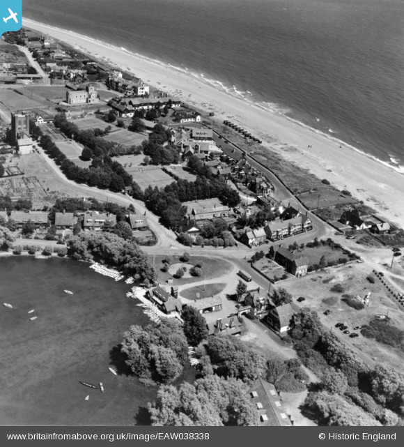
EAW038338 ENGLAND (1951). The Haven, Thorpeness, 1951. This image has been produced from a print.
© Copyright OpenStreetMap contributors and licensed by the OpenStreetMap Foundation. 2026. Cartography is licensed as CC BY-SA.
Nearby Images (3)
EAW038338

EAW038335

EPW041345

Details
| Title | [EAW038338] The Haven, Thorpeness, 1951. This image has been produced from a print. |
| Reference | EAW038338 |
| Date | 2-August-1951 |
| Link | |
| Place name | ALDEBURGH |
| Parish | ALDRINGHAM CUM THORPE |
| District | |
| Country | ENGLAND |
| Easting / Northing | 647224, 259612 |
| Longitude / Latitude | 1.6165643934655, 52.178854170539 |
| National Grid Reference | TM472596 |
Pins

holidayinsuffolk |
Sunday 23rd of November 2014 09:33:37 AM | |
|
holidayinsuffolk |
Sunday 23rd of November 2014 09:33:03 AM | |
|
holidayinsuffolk |
Sunday 23rd of November 2014 09:31:38 AM | |
|
holidayinsuffolk |
Sunday 23rd of November 2014 09:31:10 AM | |
|
holidayinsuffolk |
Sunday 23rd of November 2014 09:30:35 AM | |
|
holidayinsuffolk |
Sunday 23rd of November 2014 09:29:43 AM | |
|
holidayinsuffolk |
Sunday 23rd of November 2014 09:29:42 AM | |
|
holidayinsuffolk |
Sunday 23rd of November 2014 09:29:39 AM | |
|
cptpies |
Friday 21st of November 2014 01:48:27 PM |
User Comment Contributions

Thorpeness AT blocks |
cptpies |
Friday 21st of November 2014 01:49:32 PM |