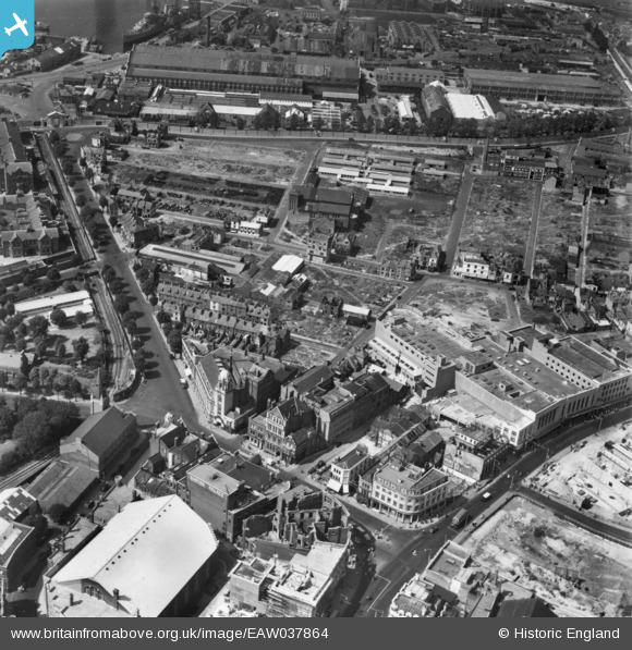
EAW037864 ENGLAND (1951). Unicorn Road, Spring Street and environs, Portsmouth, 1951. This image has been produced from a print.
    © Copyright OpenStreetMap contributors and licensed by the OpenStreetMap Foundation. 2025. Cartography is licensed as CC BY-SA.
  
Details
| Title | [EAW037864] Unicorn Road, Spring Street and environs, Portsmouth, 1951. This image has been produced from a print. | 
| Reference | EAW037864 | 
| Date | 19-July-1951 | 
| Link | |
| Place name | PORTSMOUTH | 
| Parish | |
| District | |
| Country | ENGLAND | 
| Easting / Northing | 464093, 100584 | 
| Longitude / Latitude | -1.0903947127803, 50.800702684933 | 
| National Grid Reference | SU641006 | 
Pins
|  Motorbike and sidecar (19). |   redmist | Thursday 15th of December 2022 07:57:59 PM | 
 
             
  ![[EAW037864] Unicorn Road, Spring Street and environs, Portsmouth, 1951. This image has been produced from a print.](http://britainfromabove.org.uk/sites/all/libraries/aerofilms-images/public/100x100/EAW/037/EAW037864.jpg) 
  
                                          ![[EAW023271] Cleared areas following bomb damage around Fratton and environs, Portsmouth, from the west, 1949. This image has been produced from a print.](http://britainfromabove.org.uk/sites/all/libraries/aerofilms-images/public/100x100/EAW/023/EAW023271.jpg) 
 ![[EAW035211] The city centre, Portsmouth, 1951. This image has been produced from a print.](http://britainfromabove.org.uk/sites/all/libraries/aerofilms-images/public/100x100/EAW/035/EAW035211.jpg) 
 ![[EAW035213] The Town Railway Station and environs, Portsmouth, 1951. This image has been produced from a print.](http://britainfromabove.org.uk/sites/all/libraries/aerofilms-images/public/100x100/EAW/035/EAW035213.jpg)