
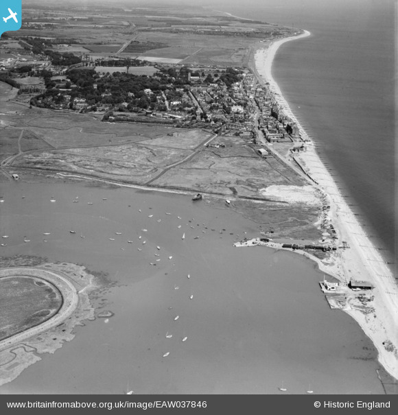
EAW037846 ENGLAND (1951). The town, Aldeburgh, from the south, 1951
© Copyright OpenStreetMap contributors and licensed by the OpenStreetMap Foundation. 2026. Cartography is licensed as CC BY-SA.
Details
| Title | [EAW037846] The town, Aldeburgh, from the south, 1951 |
| Reference | EAW037846 |
| Date | 17-July-1951 |
| Link | |
| Place name | ALDEBURGH |
| Parish | ALDEBURGH |
| District | |
| Country | ENGLAND |
| Easting / Northing | 646202, 255516 |
| Longitude / Latitude | 1.5986761980762, 52.142554701046 |
| National Grid Reference | TM462555 |
Pins

SteveCBR |
Thursday 23rd of March 2023 01:15:55 PM | |
|
SteveCBR |
Thursday 23rd of March 2023 01:14:38 PM | |
|
SteveCBR |
Thursday 23rd of March 2023 01:14:16 PM | |
|
Caws |
Friday 21st of February 2020 11:00:24 AM | |
|
Al |
Tuesday 16th of June 2015 12:00:49 AM | |
|
Al |
Tuesday 16th of June 2015 12:00:19 AM | |
|
Graham Yaxley |
Saturday 17th of January 2015 06:47:50 PM | |
|
cptpies |
Thursday 8th of May 2014 11:45:06 AM | |
|
cptpies |
Thursday 8th of May 2014 11:44:46 AM | |
|
cptpies |
Thursday 8th of May 2014 11:43:58 AM |
User Comment Contributions

Emergency Coast Battery and Anti Tank obstacles |
cptpies |
Thursday 8th of May 2014 11:45:54 AM |