
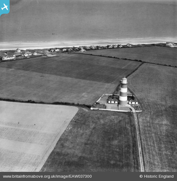
EAW037300 ENGLAND (1951). High Lighthouse, Happisburgh, 1951. This image has been produced from a print.
© Copyright OpenStreetMap contributors and licensed by the OpenStreetMap Foundation. 2026. Cartography is licensed as CC BY-SA.
Nearby Images (2)
EAW037300

EAW037299

Details
| Title | [EAW037300] High Lighthouse, Happisburgh, 1951. This image has been produced from a print. |
| Reference | EAW037300 |
| Date | 21-June-1951 |
| Link | |
| Place name | HAPPISBURGH |
| Parish | HAPPISBURGH |
| District | |
| Country | ENGLAND |
| Easting / Northing | 638443, 330688 |
| Longitude / Latitude | 1.5392922627494, 52.820558900428 |
| National Grid Reference | TG384307 |
Pins

Matt Aldred edob.mattaldred.com |
Monday 8th of March 2021 03:56:51 PM | |

toriangel |
Wednesday 6th of November 2019 04:49:17 PM | |
|
Mark P |
Tuesday 3rd of September 2019 07:56:10 PM |