
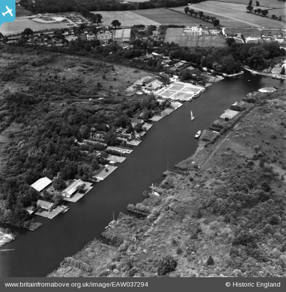
EAW037294 ENGLAND (1951). The River Bure, Horning, 1951. This image has been produced from a print.
© Copyright OpenStreetMap contributors and licensed by the OpenStreetMap Foundation. 2026. Cartography is licensed as CC BY-SA.
Nearby Images (3)
EAW037294

EPW059155

EAW037293

Details
| Title | [EAW037294] The River Bure, Horning, 1951. This image has been produced from a print. |
| Reference | EAW037294 |
| Date | 21-June-1951 |
| Link | |
| Place name | HORNING |
| Parish | HORNING |
| District | |
| Country | ENGLAND |
| Easting / Northing | 633753, 317465 |
| Longitude / Latitude | 1.4603869726196, 52.703947672321 |
| National Grid Reference | TG338175 |
Pins
Be the first to add a comment to this image!