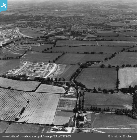
EAW037263 ENGLAND (1951). Maypole Farm looking towards Colchester, Maypole Green, from the south, 1951. This image has been produced from a print.
© Copyright OpenStreetMap contributors and licensed by the OpenStreetMap Foundation. 2026. Cartography is licensed as CC BY-SA.
Details
| Title | [EAW037263] Maypole Farm looking towards Colchester, Maypole Green, from the south, 1951. This image has been produced from a print. |
| Reference | EAW037263 |
| Date | 21-June-1951 |
| Link | |
| Place name | MAYPOLE GREEN |
| Parish | |
| District | |
| Country | ENGLAND |
| Easting / Northing | 598609, 221829 |
| Longitude / Latitude | 0.88456955384882, 51.859203011517 |
| National Grid Reference | TL986218 |
Pins

Stephen Mirrington |
Wednesday 1st of October 2025 10:49:17 AM | |

Stephen Mirrington |
Wednesday 1st of October 2025 10:48:54 AM | |

Stephen Mirrington |
Wednesday 1st of October 2025 10:48:21 AM | |

The Laird |
Wednesday 1st of January 2020 08:47:25 PM | |

The Laird |
Wednesday 1st of January 2020 08:45:32 PM | |

The Laird |
Wednesday 1st of January 2020 08:43:24 PM |


![[EAW037263] Maypole Farm looking towards Colchester, Maypole Green, from the south, 1951. This image has been produced from a print.](http://britainfromabove.org.uk/sites/all/libraries/aerofilms-images/public/100x100/EAW/037/EAW037263.jpg)
![[EAW037259] Maypole Farm, Maypole Green, 1951. This image has been produced from a print marked by Aerofilms Ltd for photo editing.](http://britainfromabove.org.uk/sites/all/libraries/aerofilms-images/public/100x100/EAW/037/EAW037259.jpg)
![[EAW037260] Maypole Farm, The Maypole and Maypole Green Road, Maypole Green, 1951. This image has been produced from a print marked by Aerofilms Ltd for photo editing.](http://britainfromabove.org.uk/sites/all/libraries/aerofilms-images/public/100x100/EAW/037/EAW037260.jpg)