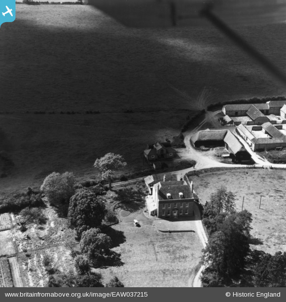
EAW037215 ENGLAND (1951). Manor Farm, Old Alresford, 1951. This image has been produced from a print.
© Copyright OpenStreetMap contributors and licensed by the OpenStreetMap Foundation. 2025. Cartography is licensed as CC BY-SA.
Nearby Images (9)
Details
| Title | [EAW037215] Manor Farm, Old Alresford, 1951. This image has been produced from a print. |
| Reference | EAW037215 |
| Date | 13-June-1951 |
| Link | |
| Place name | OLD ALRESFORD |
| Parish | OLD ALRESFORD |
| District | |
| Country | ENGLAND |
| Easting / Northing | 458429, 133802 |
| Longitude / Latitude | -1.1654359559937, 51.100011356237 |
| National Grid Reference | SU584338 |
Pins
Be the first to add a comment to this image!


![[EAW037215] Manor Farm, Old Alresford, 1951. This image has been produced from a print.](http://britainfromabove.org.uk/sites/all/libraries/aerofilms-images/public/100x100/EAW/037/EAW037215.jpg)
![[EAW040894] Manor Farm and the watercress beds, Old Alresford, 1951. This image has been produced from a print marked by Aerofilms Ltd for photo editing.](http://britainfromabove.org.uk/sites/all/libraries/aerofilms-images/public/100x100/EAW/040/EAW040894.jpg)
![[EAW037213] Manor Farm, Old Alresford, 1951. This image has been produced from a print marked by Aerofilms Ltd for photo editing.](http://britainfromabove.org.uk/sites/all/libraries/aerofilms-images/public/100x100/EAW/037/EAW037213.jpg)
![[EAW037212] Manor Farm, Old Alresford, from the south-east, 1951. This image has been produced from a print marked by Aerofilms Ltd for photo editing.](http://britainfromabove.org.uk/sites/all/libraries/aerofilms-images/public/100x100/EAW/037/EAW037212.jpg)
![[EAW040889] Manor Farm and nearby watercress beds, Old Alresford, 1951. This image was marked by Aerofilms Ltd for photo editing.](http://britainfromabove.org.uk/sites/all/libraries/aerofilms-images/public/100x100/EAW/040/EAW040889.jpg)
![[EAW037214] Manor Farm, Old Alresford, 1951. This image has been produced from a print marked by Aerofilms Ltd for photo editing.](http://britainfromabove.org.uk/sites/all/libraries/aerofilms-images/public/100x100/EAW/037/EAW037214.jpg)
![[EAW040895] Manor Farm and the watercress beds, Old Alresford, 1951. This image has been produced from a print marked by Aerofilms Ltd for photo editing.](http://britainfromabove.org.uk/sites/all/libraries/aerofilms-images/public/100x100/EAW/040/EAW040895.jpg)
![[EAW040893] Manor Farm and the watercress beds, Old Alresford, from the south-east, 1951. This image has been produced from a print marked by Aerofilms Ltd for photo editing.](http://britainfromabove.org.uk/sites/all/libraries/aerofilms-images/public/100x100/EAW/040/EAW040893.jpg)
![[EAW040891] Manor Farm and nearby watercress beds, Old Alresford, 1951. This image has been produced from a print marked by Aerofilms Ltd for photo editing.](http://britainfromabove.org.uk/sites/all/libraries/aerofilms-images/public/100x100/EAW/040/EAW040891.jpg)