
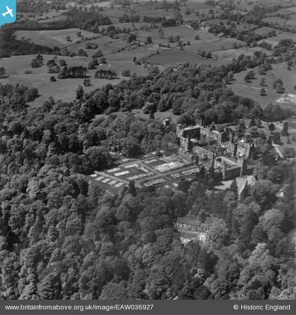
EAW036927 ENGLAND (1951). Alton Towers, Alton Park, 1951. This image has been produced from a print.
© Copyright OpenStreetMap contributors and licensed by the OpenStreetMap Foundation. 2026. Cartography is licensed as CC BY-SA.
Nearby Images (9)
EAW036927

EPW005741

EAW024742

EPW020027

EAW024741

EPW020026

EAW036928

EPW020025

EPW020024

Details
| Title | [EAW036927] Alton Towers, Alton Park, 1951. This image has been produced from a print. |
| Reference | EAW036927 |
| Date | 7-June-1951 |
| Link | |
| Place name | ALTON PARK |
| Parish | FARLEY |
| District | |
| Country | ENGLAND |
| Easting / Northing | 407191, 343130 |
| Longitude / Latitude | -1.8928745711105, 52.985150769962 |
| National Grid Reference | SK072431 |
Pins

bescotbeast |
Sunday 21st of December 2014 04:03:21 AM |