
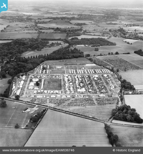
EAW036746 ENGLAND (1951). Rougham, the Suffolk County Show, from the south, 1951. This image has been produced from a print.
© Copyright OpenStreetMap contributors and licensed by the OpenStreetMap Foundation. 2026. Cartography is licensed as CC BY-SA.
Nearby Images (2)
EAW036746

EAW036756

Details
| Title | [EAW036746] Rougham, the Suffolk County Show, from the south, 1951. This image has been produced from a print. |
| Reference | EAW036746 |
| Date | 7-June-1951 |
| Link | |
| Place name | ROUGHAM |
| Parish | RUSHBROOKE WITH ROUGHAM |
| District | |
| Country | ENGLAND |
| Easting / Northing | 591552, 263240 |
| Longitude / Latitude | 0.80541848807052, 52.233581059362 |
| National Grid Reference | TL916632 |
Pins

Matt Aldred edob.mattaldred.com |
Thursday 7th of March 2024 09:42:59 AM | |
|
Matt Aldred edob.mattaldred.com |
Friday 22nd of September 2023 05:35:16 PM |