
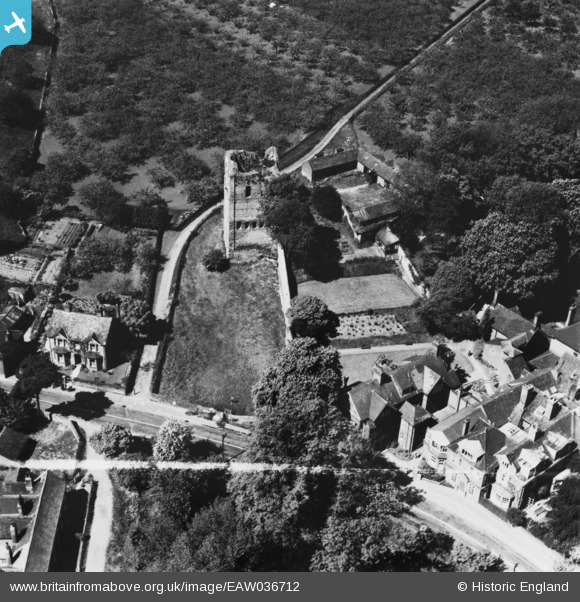
EAW036712 ENGLAND (1951). St Leonard's Tower, West Malling, 1951. This image has been produced from a print marked by Aerofilms Ltd for photo editing.
© Copyright OpenStreetMap contributors and licensed by the OpenStreetMap Foundation. 2026. Cartography is licensed as CC BY-SA.
Nearby Images (6)
EAW036712

EAW036713

EAW023966

EPW026084

EAW036711
, West Malling, 1951. This image has been produced from a print marked by Aerofilms Ltd for photo editing.")
EAW036710
, West Malling, 1951. This image has been produced from a print marked by Aerofilms Ltd for photo editing.")
Details
| Title | [EAW036712] St Leonard's Tower, West Malling, 1951. This image has been produced from a print marked by Aerofilms Ltd for photo editing. |
| Reference | EAW036712 |
| Date | 1-June-1951 |
| Link | |
| Place name | WEST MALLING |
| Parish | WEST MALLING |
| District | |
| Country | ENGLAND |
| Easting / Northing | 567603, 157089 |
| Longitude / Latitude | 0.40382087696998, 51.287731218227 |
| National Grid Reference | TQ676571 |
Pins
Be the first to add a comment to this image!