
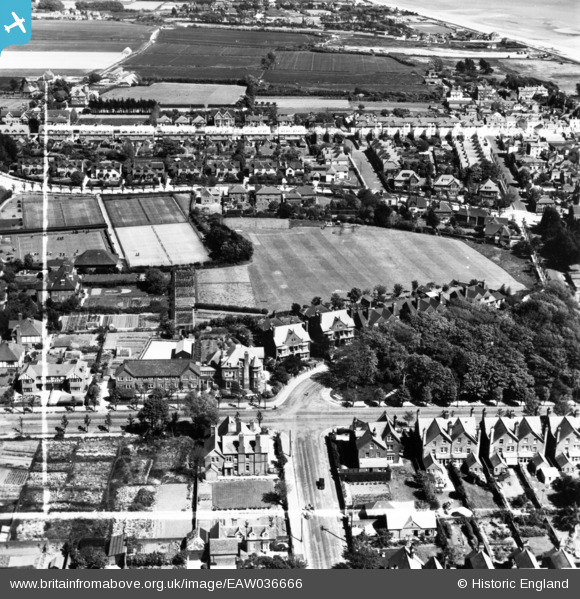
EAW036666 ENGLAND (1951). Playing field behind Granville Road and environs, Littlehampton, 1951. This image has been produced from a print marked by Aerofilms Ltd for photo editing.
© Copyright OpenStreetMap contributors and licensed by the OpenStreetMap Foundation. 2026. Cartography is licensed as CC BY-SA.
Nearby Images (8)
EAW036666

EAW036673

EAW036669

EAW036668

EAW036667

EAW036672

EAW036670

EAW036671

Details
| Title | [EAW036666] Playing field behind Granville Road and environs, Littlehampton, 1951. This image has been produced from a print marked by Aerofilms Ltd for photo editing. |
| Reference | EAW036666 |
| Date | 1-June-1951 |
| Link | |
| Place name | LITTLEHAMPTON |
| Parish | LITTLEHAMPTON |
| District | |
| Country | ENGLAND |
| Easting / Northing | 503267, 101799 |
| Longitude / Latitude | -0.53425444028807, 50.805968170454 |
| National Grid Reference | TQ033018 |
Pins
Be the first to add a comment to this image!
User Comment Contributions
The playing field is in fact the sports field of Furzedown School, a Preparatory School for Boys , Headmaster Mr Godfray. |

RDWK77 |
Wednesday 2nd of December 2015 08:33:39 AM |