
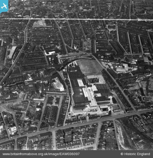
EAW036097 ENGLAND (1951). The Trent Sanitary Works (Earthenware) and environs, Hanley, 1951. This image has been produced from a print marked by Aerofilms Ltd for photo editing.
© Copyright OpenStreetMap contributors and licensed by the OpenStreetMap Foundation. 2026. Cartography is licensed as CC BY-SA.
Nearby Images (12)
EAW036097
 and environs, Hanley, 1951. This image has been produced from a print marked by Aerofilms Ltd for photo editing.")
EAW036096
 and environs, Hanley, 1951. This image has been produced from a print marked by Aerofilms Ltd for photo editing.")
EAW036095
 and environs, Hanley, 1951. This image has been produced from a print marked by Aerofilms Ltd for photo editing.")
EPW036110

EAW036099
 and environs, Hanley, 1951. This image has been produced from a print marked by Aerofilms Ltd for photo editing.")
EAW036098
 and environs, Hanley, 1951. This image has been produced from a print marked by Aerofilms Ltd for photo editing.")
EAW036100
 and environs, Hanley, 1951. This image has been produced from a print marked by Aerofilms Ltd for photo editing.")
EAW036104
 and environs, Hanley, 1951. This image has been produced from a print marked by Aerofilms Ltd for photo editing.")
EAW036102
 and environs, Hanley, 1951. This image has been produced from a print marked by Aerofilms Ltd for photo editing.")
EAW036101
 and environs, Hanley, 1951. This image has been produced from a print marked by Aerofilms Ltd for photo editing.")
EAW036103
 and environs, Hanley, 1951. This image has been produced from a print marked by Aerofilms Ltd for photo editing.")
EPW053358
, Hanley, 1937")
Details
| Title | [EAW036097] The Trent Sanitary Works (Earthenware) and environs, Hanley, 1951. This image has been produced from a print marked by Aerofilms Ltd for photo editing. |
| Reference | EAW036097 |
| Date | 18-May-1951 |
| Link | |
| Place name | HANLEY |
| Parish | |
| District | |
| Country | ENGLAND |
| Easting / Northing | 388868, 347015 |
| Longitude / Latitude | -2.1659687823313, 53.020010214585 |
| National Grid Reference | SJ889470 |
Pins

Mozzerscfc |
Saturday 30th of January 2016 12:56:54 PM | |
|
Mozzerscfc |
Saturday 30th of January 2016 12:53:33 PM | |
|
Mozzerscfc |
Saturday 30th of January 2016 12:52:25 PM | |
|
Mozzerscfc |
Saturday 30th of January 2016 12:51:06 PM | |
|
Mozzerscfc |
Saturday 30th of January 2016 12:50:11 PM | |
|
Mozzerscfc |
Saturday 30th of January 2016 12:49:03 PM | |
|
Mozzerscfc |
Saturday 30th of January 2016 12:47:17 PM | |
|
Mozzerscfc |
Saturday 30th of January 2016 12:47:15 PM |