
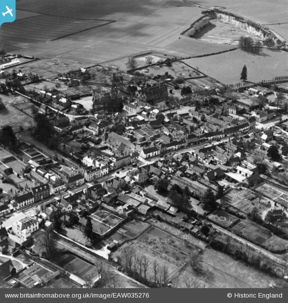
EAW035276 ENGLAND (1951). The High Street and the village, Odiham, 1951. This image has been produced from a print.
© Copyright OpenStreetMap contributors and licensed by the OpenStreetMap Foundation. 2026. Cartography is licensed as CC BY-SA.
Nearby Images (21)
EAW035276

EPW022768

EPW022767

EPW022769

EPW033546

EAW022186

EPW022765

EAW035277

EAW035275

EAW022189

EAW022187

EAW035280

EAW022188

EPW022766

EAW035281

EPW022764

EAW035279

EAW035278

EPW033548

EAW022185

EPW033549

Details
| Title | [EAW035276] The High Street and the village, Odiham, 1951. This image has been produced from a print. |
| Reference | EAW035276 |
| Date | 5-April-1951 |
| Link | |
| Place name | ODIHAM |
| Parish | ODIHAM |
| District | |
| Country | ENGLAND |
| Easting / Northing | 474104, 151045 |
| Longitude / Latitude | -0.9380243927419, 51.253238996792 |
| National Grid Reference | SU741510 |
Pins
Be the first to add a comment to this image!