
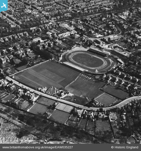
EAW035227 ENGLAND (1951). The Hampshire County Cricket Ground and adjacent stadium at Banister's Park, Southampton, 1951. This image has been produced from a print.
© Copyright OpenStreetMap contributors and licensed by the OpenStreetMap Foundation. 2026. Cartography is licensed as CC BY-SA.
Nearby Images (5)
EAW035227

EAW035228

EAW035626

EAW035225

EAW035226

Details
| Title | [EAW035227] The Hampshire County Cricket Ground and adjacent stadium at Banister's Park, Southampton, 1951. This image has been produced from a print. |
| Reference | EAW035227 |
| Date | 6-April-1951 |
| Link | |
| Place name | SOUTHAMPTON |
| Parish | |
| District | |
| Country | ENGLAND |
| Easting / Northing | 441595, 113464 |
| Longitude / Latitude | -1.4081980203346, 50.918585121874 |
| National Grid Reference | SU416135 |
Pins
Be the first to add a comment to this image!