
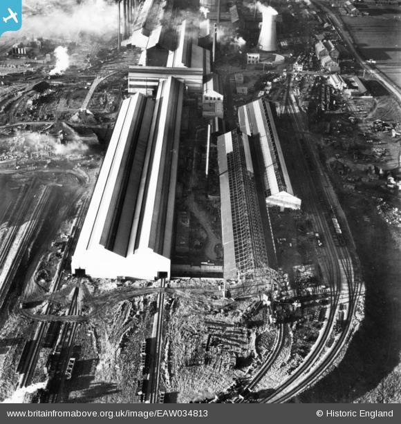
EAW034813 ENGLAND (1951). Part of the John Lysaght Normanby Park Steel Works under construction, Scunthorpe, 1951. This image has been produced from a print.
© Copyright OpenStreetMap contributors and licensed by the OpenStreetMap Foundation. 2026. Cartography is licensed as CC BY-SA.
Nearby Images (48)
EAW009412

EAW038754

EAW038756

EAW031168

EAW013492

EAW038777

EAW027163

EAW034810

EAW038749

EAW038759

EAW013825

EAW023922

EAW038764

EAW021127

EAW038758

EAW038753

EAW023920

EAW027171

EAW038755

EAW021130

EAW021141
, Scunthorpe, 1949. This image has been produced from a damaged negative.")
EAW013491

EAW009413

EAW034802

EAW013496

EAW021129

EAW031169

EAW028577

EAW034808

EAW013495

EAW013494

EAW031176

EAW019677

EAW034809

EAW027167

EAW038767

EAW031180

EAW034807

EAW009627

EAW016659

EAW041829

EAW028576

EAW027168

EAW034820

EAW041838

EAW009414

EAW034798

EAW041831

Details
| Title | [EAW034813] Part of the John Lysaght Normanby Park Steel Works under construction, Scunthorpe, 1951. This image has been produced from a print. |
| Reference | EAW034813 |
| Date | 27-February-1951 |
| Link | |
| Place name | SCUNTHORPE |
| Parish | |
| District | |
| Country | ENGLAND |
| Easting / Northing | 489072, 413153 |
| Longitude / Latitude | -0.65362748070276, 53.60711584265 |
| National Grid Reference | SE891132 |
Pins
Be the first to add a comment to this image!