
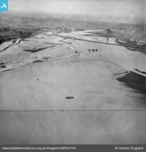
EAW034744 ENGLAND (1951). The River Chelmer in flood between Chelmsford and Great Baddow, Chelmsford, from the east, 1951
© Copyright OpenStreetMap contributors and licensed by the OpenStreetMap Foundation. 2026. Cartography is licensed as CC BY-SA.
Nearby Images (2)
EAW034744

EAW034746

Details
| Title | [EAW034744] The River Chelmer in flood between Chelmsford and Great Baddow, Chelmsford, from the east, 1951 |
| Reference | EAW034744 |
| Date | 21-February-1951 |
| Link | |
| Place name | CHELMSFORD |
| Parish | GREAT BADDOW |
| District | |
| Country | ENGLAND |
| Easting / Northing | 572607, 206223 |
| Longitude / Latitude | 0.49957116284123, 51.727657108165 |
| National Grid Reference | TL726062 |
Pins

Matt Aldred edob.mattaldred.com |
Thursday 5th of October 2023 11:31:54 AM | |

Ian |
Saturday 26th of April 2014 01:49:36 PM | |
|
Ian |
Saturday 26th of April 2014 01:47:10 PM | |
|
Ian |
Saturday 26th of April 2014 01:46:28 PM | |
|
Ian |
Saturday 26th of April 2014 01:45:02 PM | |
|
Ian |
Saturday 26th of April 2014 01:44:13 PM | |
|
Ian |
Saturday 26th of April 2014 01:43:25 PM | |
|
Ian |
Saturday 26th of April 2014 01:40:42 PM |