
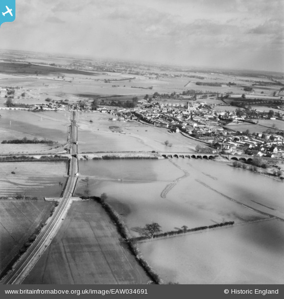
EAW034691 ENGLAND (1951). The River Nene in flood at Thrapston, Woodford, from the south, 1951
© Copyright OpenStreetMap contributors and licensed by the OpenStreetMap Foundation. 2026. Cartography is licensed as CC BY-SA.
Nearby Images (3)
EAW034691

EAW034690

EAW034692

Details
| Title | [EAW034691] The River Nene in flood at Thrapston, Woodford, from the south, 1951 |
| Reference | EAW034691 |
| Date | 19-February-1951 |
| Link | |
| Place name | WOODFORD |
| Parish | WOODFORD |
| District | |
| Country | ENGLAND |
| Easting / Northing | 499127, 277759 |
| Longitude / Latitude | -0.54324131404148, 52.388492532929 |
| National Grid Reference | SP991778 |
Pins
Be the first to add a comment to this image!