
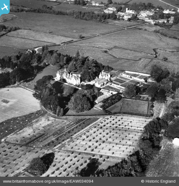
EAW034094 ENGLAND (1950). Southover House, Tolpuddle, 1950. This image has been produced from a print.
© Copyright OpenStreetMap contributors and licensed by the OpenStreetMap Foundation. 2026. Cartography is licensed as CC BY-SA.
Nearby Images (8)
EAW034094

EAW034092

EAW034095

EAW034096

EAW034091

EAW034089

EAW034090

EAW034093

Details
| Title | [EAW034094] Southover House, Tolpuddle, 1950. This image has been produced from a print. |
| Reference | EAW034094 |
| Date | 25-October-1950 |
| Link | |
| Place name | TOLPUDDLE |
| Parish | TOLPUDDLE |
| District | |
| Country | ENGLAND |
| Easting / Northing | 379193, 93937 |
| Longitude / Latitude | -2.2949336980001, 50.74409508377 |
| National Grid Reference | SY792939 |
Pins
Be the first to add a comment to this image!