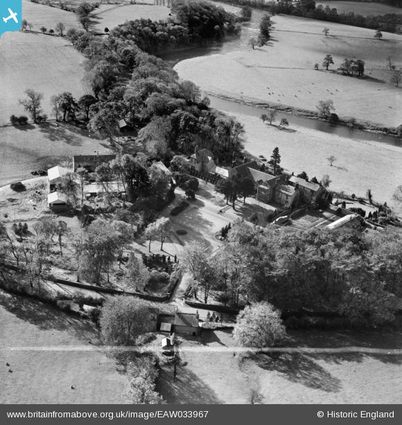
EAW033967 ENGLAND (1950). Mitton Hall and Mitton Hall Farm, Whalley, 1950. This image was marked by Aerofilms Ltd for photo editing.
© Copyright OpenStreetMap contributors and licensed by the OpenStreetMap Foundation. 2025. Cartography is licensed as CC BY-SA.
Nearby Images (9)
Details
| Title | [EAW033967] Mitton Hall and Mitton Hall Farm, Whalley, 1950. This image was marked by Aerofilms Ltd for photo editing. |
| Reference | EAW033967 |
| Date | 14-October-1950 |
| Link | |
| Place name | WHALLEY |
| Parish | LITTLE MITTON |
| District | |
| Country | ENGLAND |
| Easting / Northing | 371723, 438493 |
| Longitude / Latitude | -2.4297975580841, 53.841703763444 |
| National Grid Reference | SD717385 |
Pins
Be the first to add a comment to this image!


![[EAW033967] Mitton Hall and Mitton Hall Farm, Whalley, 1950. This image was marked by Aerofilms Ltd for photo editing.](http://britainfromabove.org.uk/sites/all/libraries/aerofilms-images/public/100x100/EAW/033/EAW033967.jpg)
![[EAW033973] Mitton Hall and Mitton Hall Farm, Whalley, 1950](http://britainfromabove.org.uk/sites/all/libraries/aerofilms-images/public/100x100/EAW/033/EAW033973.jpg)
![[EAW033970] Mitton Hall and Mitton Hall Farm, Whalley, 1950. This image was marked by Aerofilms Ltd for photo editing.](http://britainfromabove.org.uk/sites/all/libraries/aerofilms-images/public/100x100/EAW/033/EAW033970.jpg)
![[EAW033968] Mitton Hall and Mitton Hall Farm, Whalley, 1950. This image was marked by Aerofilms Ltd for photo editing.](http://britainfromabove.org.uk/sites/all/libraries/aerofilms-images/public/100x100/EAW/033/EAW033968.jpg)
![[EAW033971] Mitton Hall and Mitton Hall Farm, Whalley, 1950](http://britainfromabove.org.uk/sites/all/libraries/aerofilms-images/public/100x100/EAW/033/EAW033971.jpg)
![[EAW033966] Mitton Hall, Whalley, 1950](http://britainfromabove.org.uk/sites/all/libraries/aerofilms-images/public/100x100/EAW/033/EAW033966.jpg)
![[EAW033965] Mitton Hall, Whalley, 1950. This image was marked by Aerofilms Ltd for photo editing.](http://britainfromabove.org.uk/sites/all/libraries/aerofilms-images/public/100x100/EAW/033/EAW033965.jpg)
![[EAW033969] Mitton Hall and Mitton Hall Farm, Whalley, 1950. This image was marked by Aerofilms Ltd for photo editing.](http://britainfromabove.org.uk/sites/all/libraries/aerofilms-images/public/100x100/EAW/033/EAW033969.jpg)
![[EAW033972] Mitton Bridge, the Aspinall Arms and Mitton Hall, Whalley, 1950. This image was marked by Aerofilms Ltd for photo editing.](http://britainfromabove.org.uk/sites/all/libraries/aerofilms-images/public/100x100/EAW/033/EAW033972.jpg)